Office of Coast Survey
National Oceanic and Atmospheric Administration
New Hydrographic Survey Specifications
Updates and Enhancements
US Hydro Conference
March 20, 2025
Matt Wilson 1,2
, Tyanne Faulkes 1,3
, Giuseppe Masetti 4
1
NOAA Office of Coast Survey, 2
Atlantic Hydrographic Branch, Norfolk, VA, 3
Pacific Hydrographic Branch, Seattle, WA
4
Center for Coastal and Ocean Mapping/Joint Hydrographic Center, University of New Hampshire, NH USA
National Oceanic and Atmospheric Administration
Office of Coast Survey
Current Status (1 of 2)
• “Revamped” HSSD
• Over two years of development
• First published version released in April 2024
• Used by NOAA field units in 2024 field season
• Contractors using in 2025
• Foundational components for new HSSD
• S-100 based metadata and data licensing
• Facilitate tools for automated compliance
• Best integrate with the National Bathymetric Source
(NBS)
• Accommodate external data contributions
HSSD – Hydrographic Survey
Specifications and Deliverables
National Oceanic and Atmospheric Administration
Office of Coast Survey
Current Status (2 of 2)
• HSSD Committee formed
• Responsible for support and
ongoing maintenance of HSSD
• Rapid release capability
• New HSSD updates released as
necessary (e.g. midseason)
• Multiple formats available
• PDF, Online HTML viewer, and
Portable HTML
• HSSD version 2025.0.00
• Current version, released in
January, 2025
•
National Oceanic and Atmospheric Administration
Office of Coast Survey
HSSD online
OCS Hydrographic
Specifications available
via online viewer!
https://www.nauticalcharts.noa
a.gov/publications/hssd_viewer
.html
National Oceanic and Atmospheric Administration
Office of Coast Survey
How’d it go in 2024?
• New HSSD put to the test right away
• Francis Scott Key Bridge Collapse on March 26, 2024 –
NOAA fast response, survey, and chart delivery
• Learning curve with new quality metrics
• New vocabulary for communicating data quality via S-100
based metadata attributes
• Not just one uncertainty criteria; there is a spectrum with 6
options – field units record the level achieved
• Reporting changes
• Built for speed and data throughput; not for narratives
• New deliverables formats
• BAG (grids), Geopackage (features), GeoJSON (outlines)
National Oceanic and Atmospheric Administration
Office of Coast Survey
HSSD Committee
• Responsibilities
• Answers questions regarding interpretation of HSSD
• Handles and discusses incoming change requests
• Publishes HSSD new version releases with updates
• Tickets received
• 74 as of Jan 2025 release; 54 were “processed”, with 39
tickets resulting in edits to the HSSD
• New HSSD versions
• Released as necessary (annually at minimum)
• Capability for rapid release during the field season
National Oceanic and Atmospheric Administration
Office of Coast Survey
Metadata focus
• IHO S-100 based metadata
• Values defined by NOAA Quality Metrics
• A common metadata framework
• From specification to final compilation (i.e. NBS)
• Defines data quality
• In terms of Coverage, Features, and Uncertainty
• Determines our National Bathymetry
• Added Metadata Attribution Guide
• Informs the metadata entry
• Grid and survey specific metadata
National Oceanic and Atmospheric Administration
Office of Coast Survey
• QC Tools
• Automates HSSD compliance
• Since 2015!
• Jointly developed
• CCOM/JHC and NOAA OCS
• Community effort
• Built on feedback/ideas from the users
• Version 4 released in April 2024
• HSSD 2024+ compatible
• Set Quality Metric in parameters
QC Tools
Matt Wilson
NOAA OCS (AHB)
Tyanne Faulkes
NOAA OCS (PHB)
Giuseppe Masetti
CCOM/JHC
National Oceanic and Atmospheric Administration
Office of Coast Survey
✓ 5.7 Cleaning
✓ 5.8 Uncertainty
✓ 6.1 Formats
✓ 6.3 Metadata
✓ 6.4 Resolution
✓ 6.5 Data Gaps
✓ 6.9 Density
✓ 7.0 Features
✓ 17.0 Feature Encoding
✓ 16.0 Delivery Structure
QC Tools 4 - automates HSSD
Flier Finder
Uncertainty Calculator
Holiday Finder
Grid QA
BAG Checks
Feature Scan
VALSOU Checks
QC Tools inputs:
Hydrographic Data Delivery
✓ Grids
• Verifies uncertainty,
resolution (vr), density,
identifies fliers.
• Verifies BAG structure,
metadata, validity.
✓ Features
• Verify attribution,
agreement with grid.
✓ Delivery Structure
• Verifies folder structure
and file names.
Automates compliance:
National Oceanic and Atmospheric Administration
Office of Coast Survey
Ensuring BAG requirements
• BAG is the final product sent to NBS
• Many requirements for seamless compilation
• BAG structure checks
• Metadata, Elevation, Uncertainty, Tracking List
• Metadata checks
• CRS encoding, start/end dates, etc.
• Elevation and Uncertainty checks
• All nodes populated with both; not NaN; etc.
• Uncertainty not negative; within threshold; etc.
• GDAL compatibility checks
National Bathymetric Source
(NBS) compiles BAGs from
many sources
National Oceanic and Atmospheric Administration
Office of Coast Survey
QC Tools 4 BAG Checks
● “NOAA NBS” profile – fully aligned with HSSD.
○ Checks for all NBS requirements.
○ Other options – trouble spots in BAG are
“flagged”.
● “General” profile – per the BAG specification.
● Full list of checks:
https://www.hydroffice.org/manuals/qctools4/stable/qc_tool
s/hdr/qc_tools_hdr_bag_checks_how_does_it_work.html
National Oceanic and Atmospheric Administration
Office of Coast Survey
Reporting Changes
• Survey Metadata XML form
• PDF output added
• Personnel roster tab added
• New HSSD 2025 compatible forms:
• Hydrographic Survey Project Instructions
• Hydrographic Data Review
• xml 2025 schema aligned with HSSD
• Released Jan 2025
• Lead developer
• Toshi Wozumi, NOAA Hydrographic Surveys
Division (HSD)
•
National Oceanic and Atmospheric Administration
Office of Coast Survey
Ongoing Topic #1: Reporting
• Traditional narrative approach vs streamlined?
• It’s a divisive topic
• Is it possible to have both?
• XML metadata
• Contains grid and survey based metadata
• Add CRS metadata (WKT)
• Add Survey outline (GeoJSON)
• PDF printout
• Human readable
• Contains images, narrative information
National Oceanic and Atmospheric Administration
Office of Coast Survey
Ongoing Topic #2: Feature Delivery
• A new delivery format required
• Current S-57 .000 does not support CRS flexibility
• NOAA Geopackage is introduced
• Open source, CRS flexibile, and supports feature attribution
• Next steps
• Encourage Geopackage format adoption
• Geopackage compatibility in software, tools (e.g. QC Tools)
• Lead developer
• Stephen Patterson, NOAA Hydrographic Systems and
Technology Branch (HSTB)
Office of Coast Survey
National Oceanic and Atmospheric Administration
Thank you for your attention!
US Hydro Conference
March 20, 2025
Matt Wilson 1,2
, Tyanne Faulkes 1,3
, Giuseppe Masetti 4
1
NOAA Office of Coast Survey, 2
Atlantic Hydrographic Branch, Norfolk, VA, 3
Pacific Hydrographic Branch, Seattle, WA
4
Center for Coastal and Ocean Mapping/Joint Hydrographic Center, University of New Hampshire, NH USA

US Hydro 2025 - 
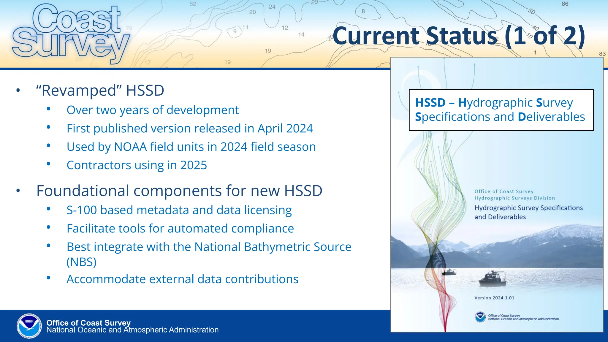
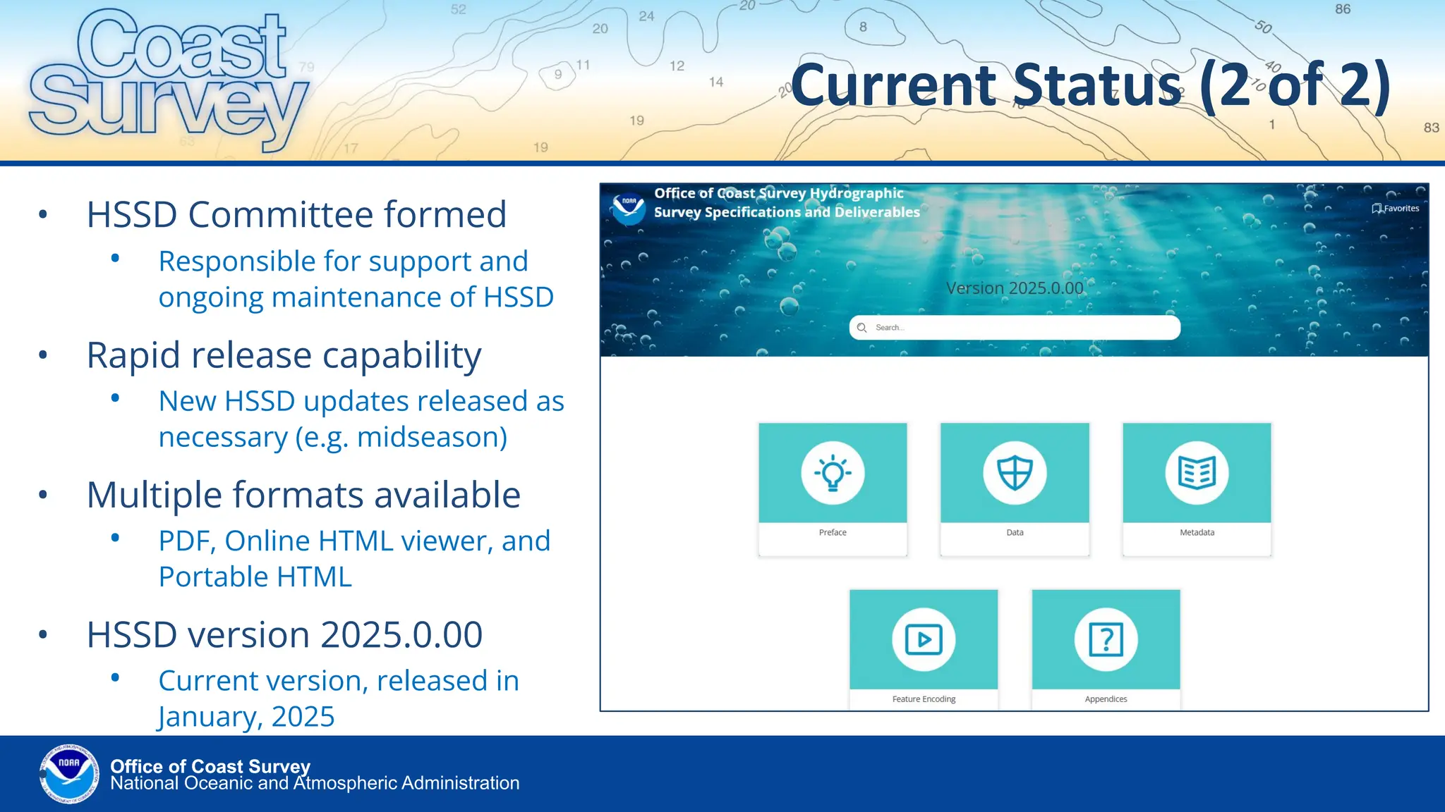
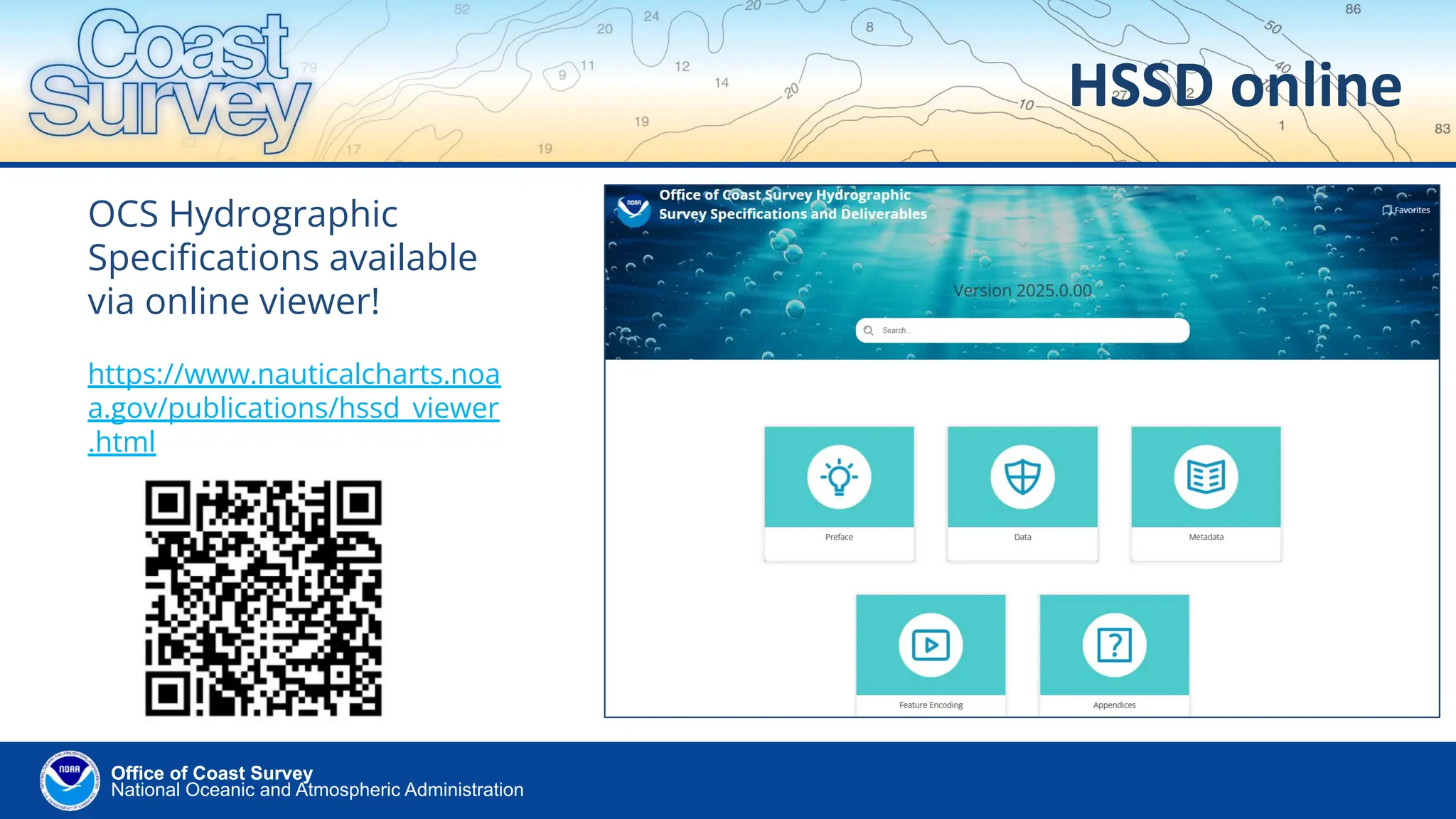
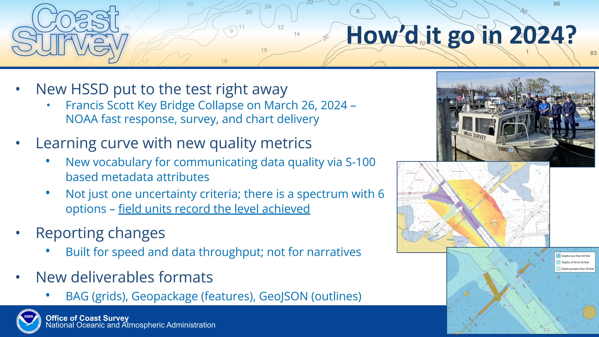
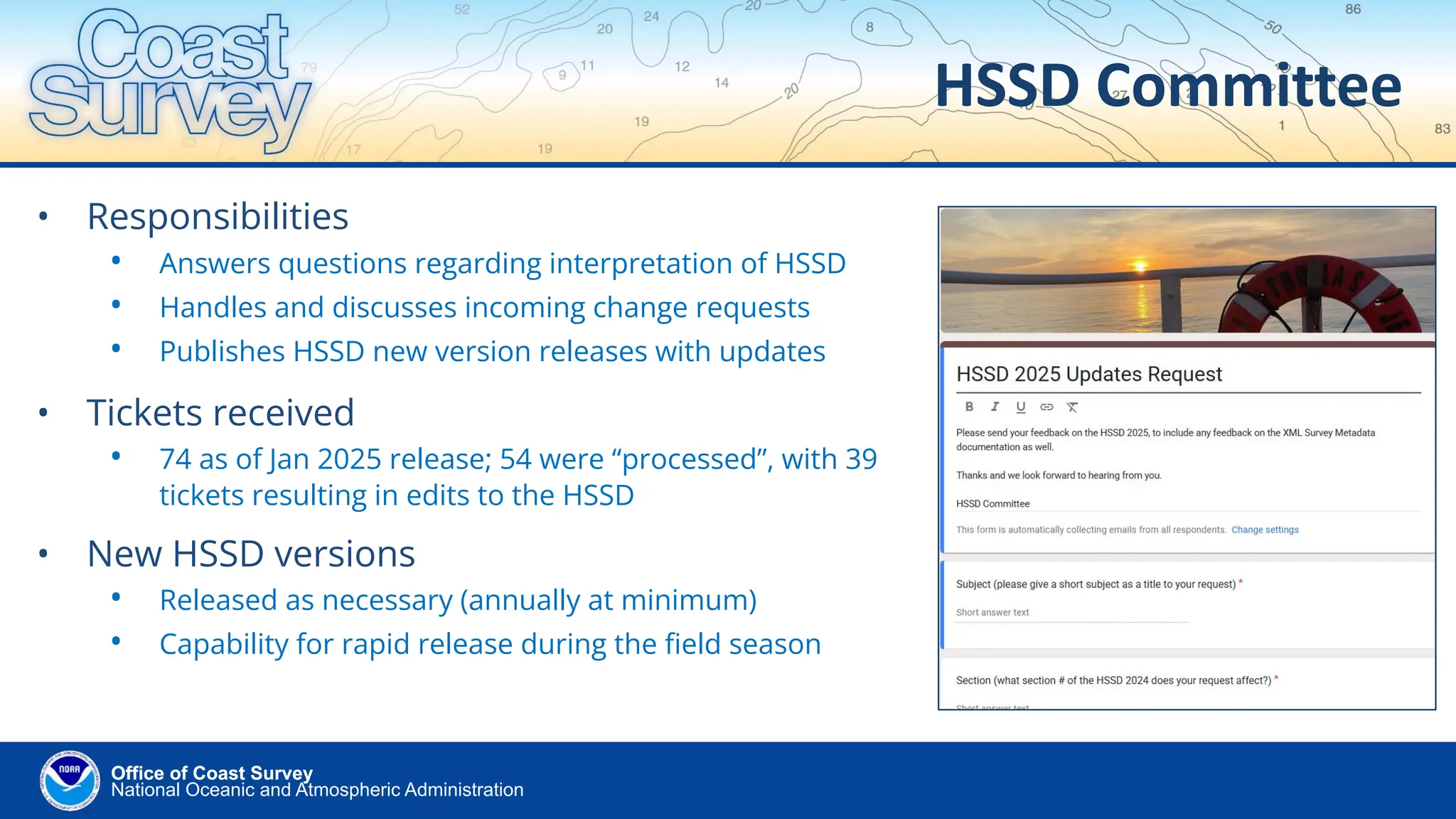
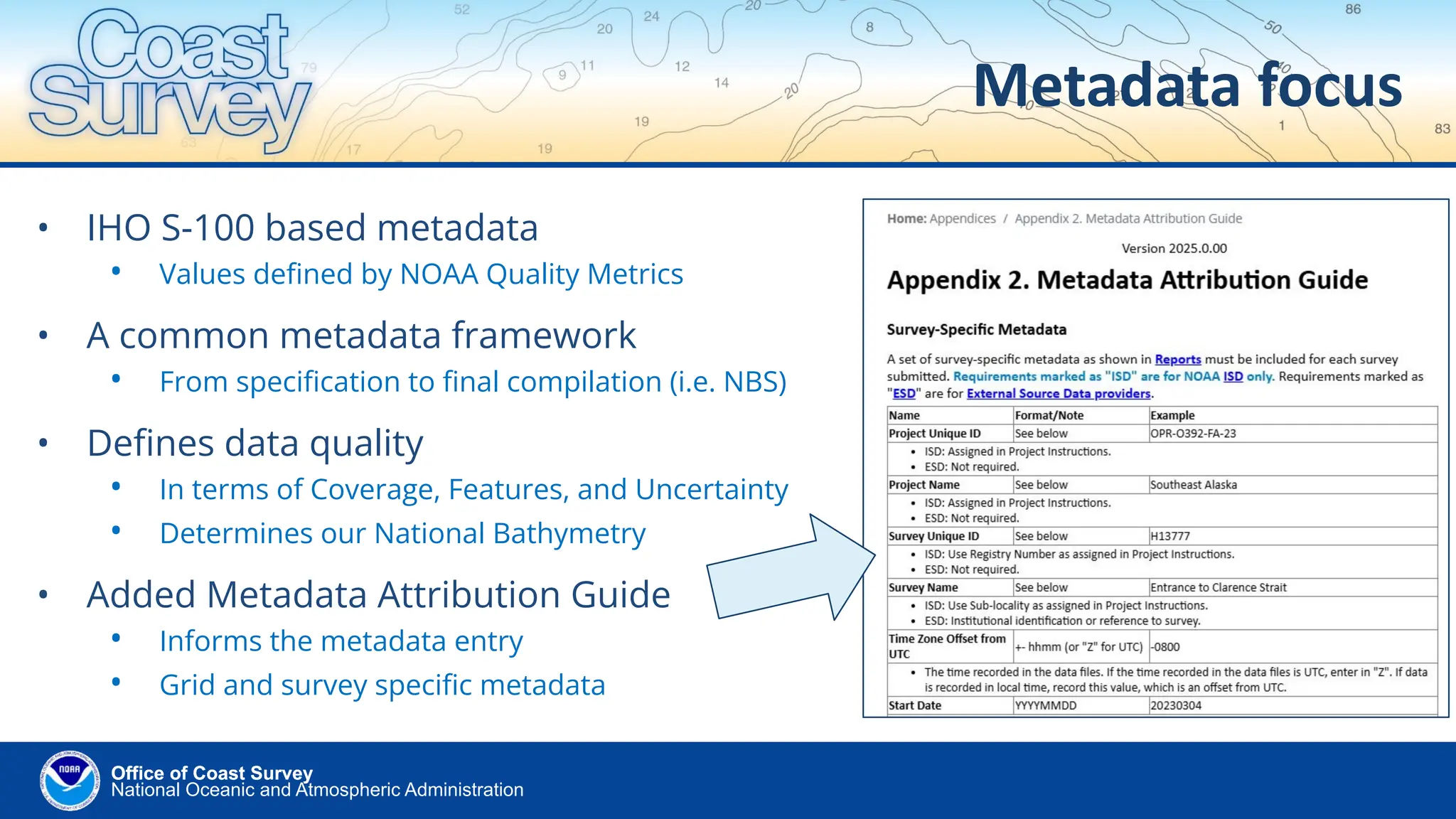
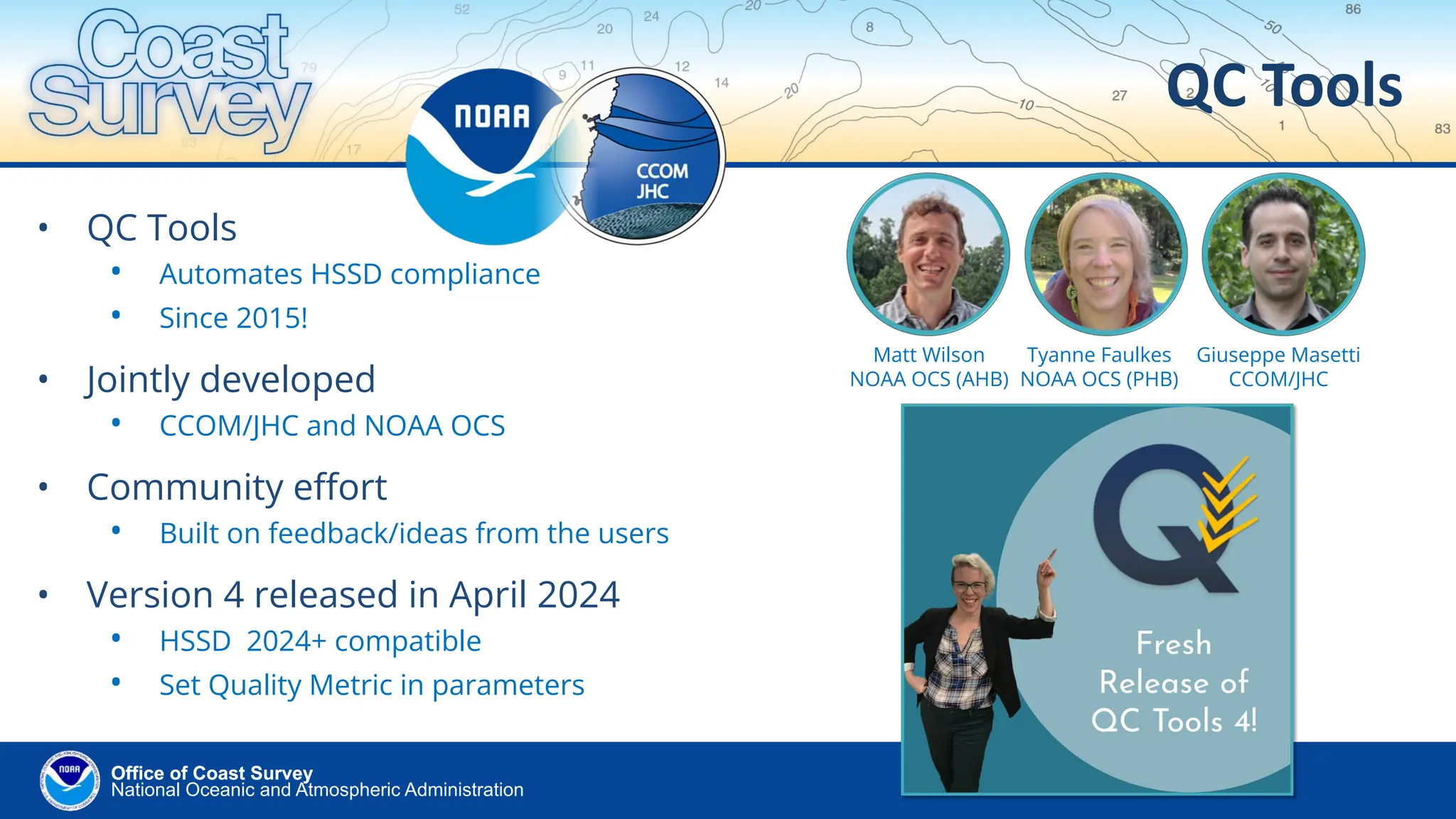
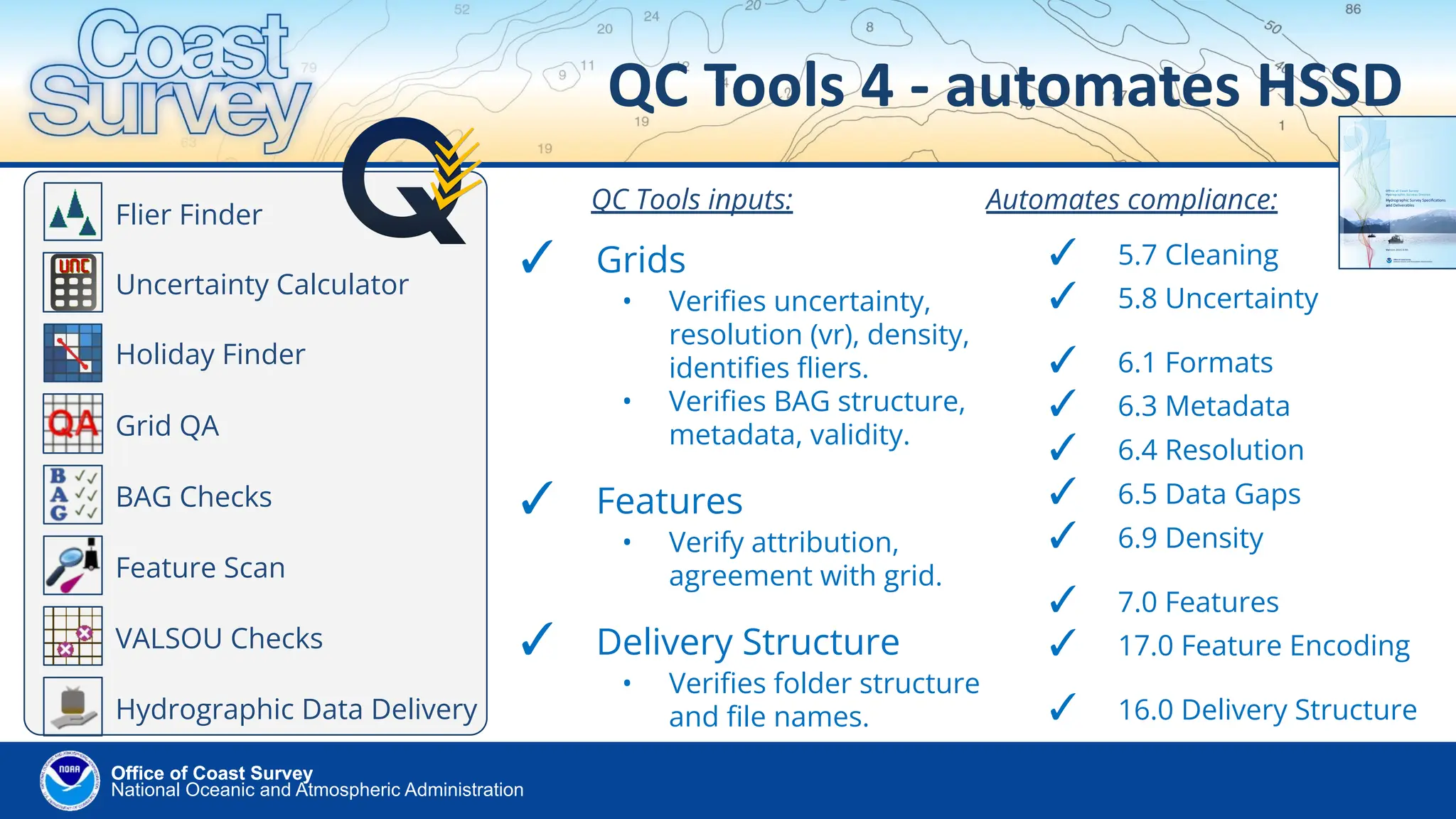
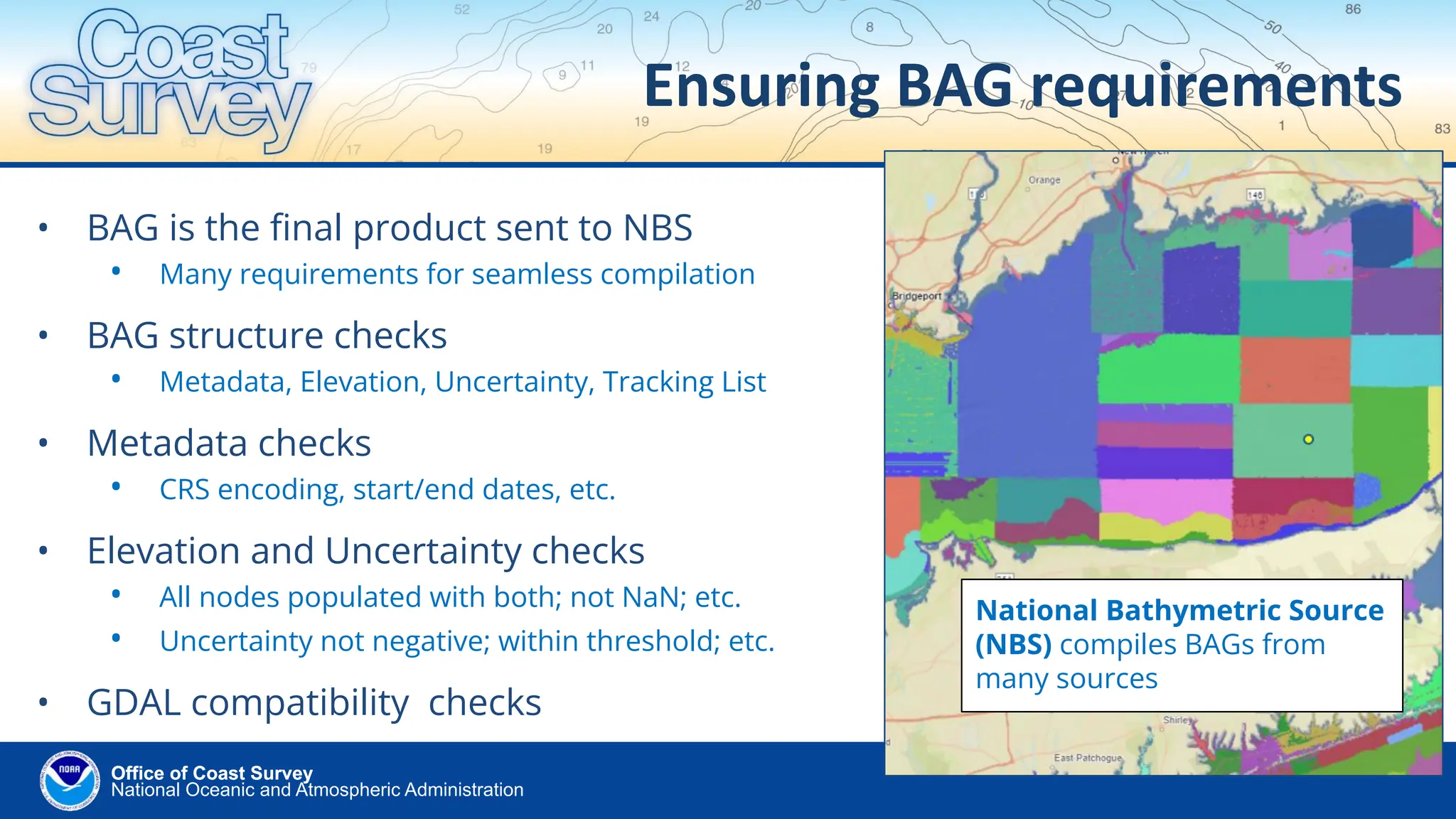
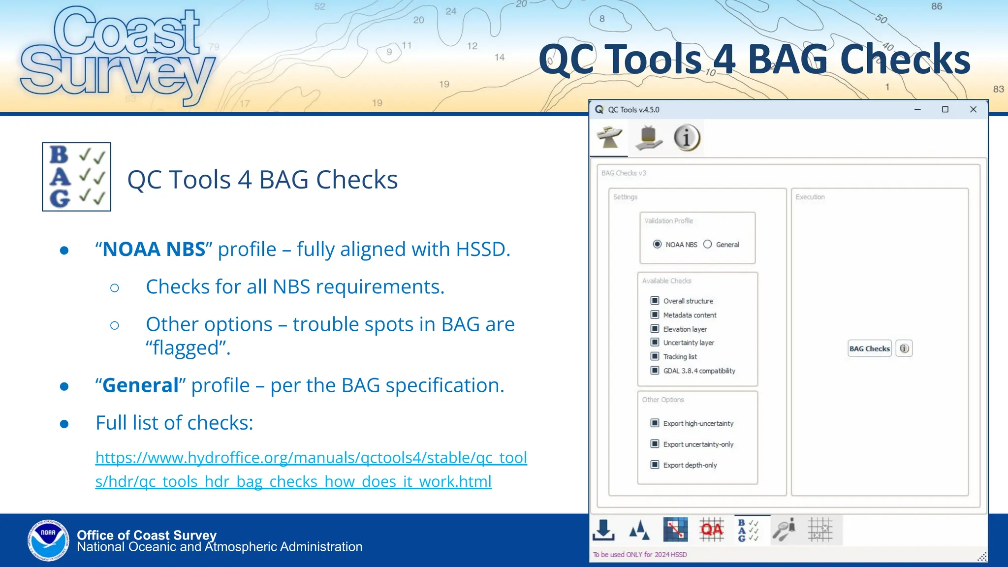
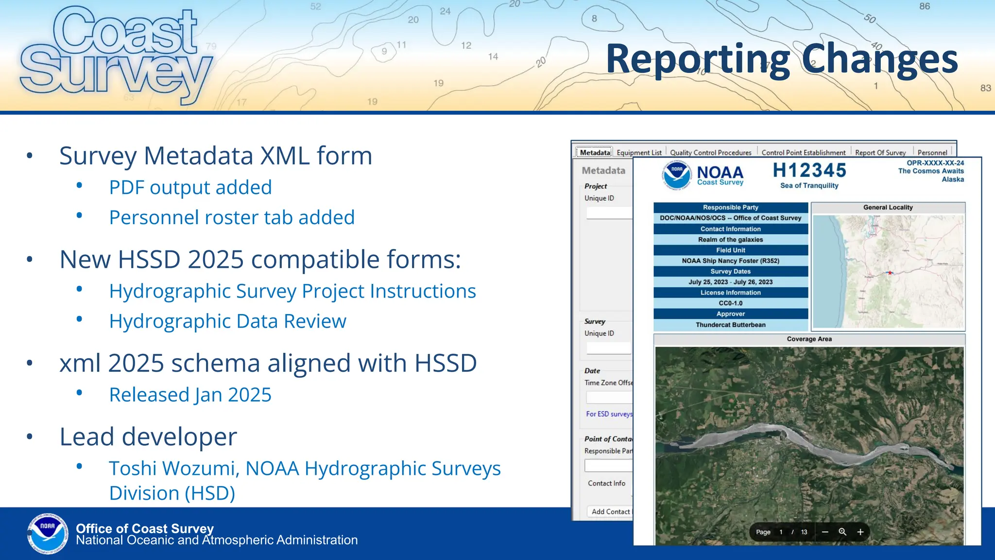
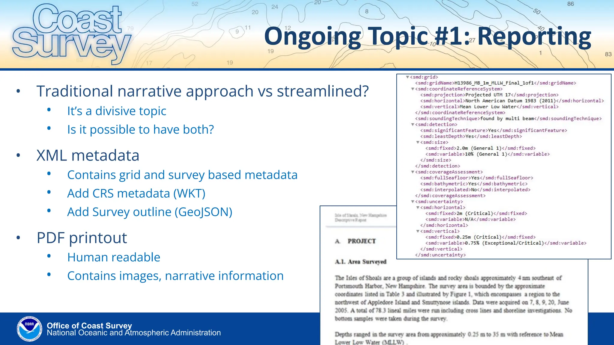
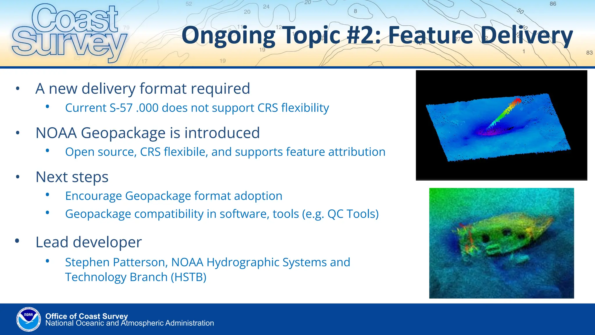
New Hydrographic Survey Specifications: Updates and Enhancements

  • 1.
    Office of CoastSurvey National Oceanic and Atmospheric Administration New Hydrographic Survey Specifications Updates and Enhancements US Hydro Conference March 20, 2025 Matt Wilson 1,2 , Tyanne Faulkes 1,3 , Giuseppe Masetti 4 1 NOAA Office of Coast Survey, 2 Atlantic Hydrographic Branch, Norfolk, VA, 3 Pacific Hydrographic Branch, Seattle, WA 4 Center for Coastal and Ocean Mapping/Joint Hydrographic Center, University of New Hampshire, NH USA
  • 2.
    National Oceanic andAtmospheric Administration Office of Coast Survey Office of Coast Survey Current Status (1 of 2) • “Revamped” HSSD • Over two years of development • First published version released in April 2024 • Used by NOAA field units in 2024 field season • Contractors using in 2025 • Foundational components for new HSSD • S-100 based metadata and data licensing • Facilitate tools for automated compliance • Best integrate with the National Bathymetric Source (NBS) • Accommodate external data contributions HSSD – Hydrographic Survey Specifications and Deliverables
  • 3.
    National Oceanic andAtmospheric Administration Office of Coast Survey Office of Coast Survey Current Status (2 of 2) • HSSD Committee formed • Responsible for support and ongoing maintenance of HSSD • Rapid release capability • New HSSD updates released as necessary (e.g. midseason) • Multiple formats available • PDF, Online HTML viewer, and Portable HTML • HSSD version 2025.0.00 • Current version, released in January, 2025 •
  • 4.
    National Oceanic andAtmospheric Administration Office of Coast Survey Office of Coast Survey HSSD online OCS Hydrographic Specifications available via online viewer! https://www.nauticalcharts.noa a.gov/publications/hssd_viewer .html
  • 5.
    National Oceanic andAtmospheric Administration Office of Coast Survey Office of Coast Survey How’d it go in 2024? • New HSSD put to the test right away • Francis Scott Key Bridge Collapse on March 26, 2024 – NOAA fast response, survey, and chart delivery • Learning curve with new quality metrics • New vocabulary for communicating data quality via S-100 based metadata attributes • Not just one uncertainty criteria; there is a spectrum with 6 options – field units record the level achieved • Reporting changes • Built for speed and data throughput; not for narratives • New deliverables formats • BAG (grids), Geopackage (features), GeoJSON (outlines)
  • 6.
    National Oceanic andAtmospheric Administration Office of Coast Survey Office of Coast Survey HSSD Committee • Responsibilities • Answers questions regarding interpretation of HSSD • Handles and discusses incoming change requests • Publishes HSSD new version releases with updates • Tickets received • 74 as of Jan 2025 release; 54 were “processed”, with 39 tickets resulting in edits to the HSSD • New HSSD versions • Released as necessary (annually at minimum) • Capability for rapid release during the field season
  • 7.
    National Oceanic andAtmospheric Administration Office of Coast Survey Office of Coast Survey Metadata focus • IHO S-100 based metadata • Values defined by NOAA Quality Metrics • A common metadata framework • From specification to final compilation (i.e. NBS) • Defines data quality • In terms of Coverage, Features, and Uncertainty • Determines our National Bathymetry • Added Metadata Attribution Guide • Informs the metadata entry • Grid and survey specific metadata
  • 8.
    National Oceanic andAtmospheric Administration Office of Coast Survey Office of Coast Survey • QC Tools • Automates HSSD compliance • Since 2015! • Jointly developed • CCOM/JHC and NOAA OCS • Community effort • Built on feedback/ideas from the users • Version 4 released in April 2024 • HSSD 2024+ compatible • Set Quality Metric in parameters QC Tools Matt Wilson NOAA OCS (AHB) Tyanne Faulkes NOAA OCS (PHB) Giuseppe Masetti CCOM/JHC
  • 9.
    National Oceanic andAtmospheric Administration Office of Coast Survey Office of Coast Survey ✓ 5.7 Cleaning ✓ 5.8 Uncertainty ✓ 6.1 Formats ✓ 6.3 Metadata ✓ 6.4 Resolution ✓ 6.5 Data Gaps ✓ 6.9 Density ✓ 7.0 Features ✓ 17.0 Feature Encoding ✓ 16.0 Delivery Structure QC Tools 4 - automates HSSD Flier Finder Uncertainty Calculator Holiday Finder Grid QA BAG Checks Feature Scan VALSOU Checks QC Tools inputs: Hydrographic Data Delivery ✓ Grids • Verifies uncertainty, resolution (vr), density, identifies fliers. • Verifies BAG structure, metadata, validity. ✓ Features • Verify attribution, agreement with grid. ✓ Delivery Structure • Verifies folder structure and file names. Automates compliance:
  • 10.
    National Oceanic andAtmospheric Administration Office of Coast Survey Office of Coast Survey Ensuring BAG requirements • BAG is the final product sent to NBS • Many requirements for seamless compilation • BAG structure checks • Metadata, Elevation, Uncertainty, Tracking List • Metadata checks • CRS encoding, start/end dates, etc. • Elevation and Uncertainty checks • All nodes populated with both; not NaN; etc. • Uncertainty not negative; within threshold; etc. • GDAL compatibility checks National Bathymetric Source (NBS) compiles BAGs from many sources
  • 11.
    National Oceanic andAtmospheric Administration Office of Coast Survey Office of Coast Survey QC Tools 4 BAG Checks QC Tools 4 BAG Checks ● “NOAA NBS” profile – fully aligned with HSSD. ○ Checks for all NBS requirements. ○ Other options – trouble spots in BAG are “flagged”. ● “General” profile – per the BAG specification. ● Full list of checks: https://www.hydroffice.org/manuals/qctools4/stable/qc_tool s/hdr/qc_tools_hdr_bag_checks_how_does_it_work.html
  • 12.
    National Oceanic andAtmospheric Administration Office of Coast Survey Office of Coast Survey Reporting Changes • Survey Metadata XML form • PDF output added • Personnel roster tab added • New HSSD 2025 compatible forms: • Hydrographic Survey Project Instructions • Hydrographic Data Review • xml 2025 schema aligned with HSSD • Released Jan 2025 • Lead developer • Toshi Wozumi, NOAA Hydrographic Surveys Division (HSD) •
  • 13.
    National Oceanic andAtmospheric Administration Office of Coast Survey Office of Coast Survey Ongoing Topic #1: Reporting • Traditional narrative approach vs streamlined? • It’s a divisive topic • Is it possible to have both? • XML metadata • Contains grid and survey based metadata • Add CRS metadata (WKT) • Add Survey outline (GeoJSON) • PDF printout • Human readable • Contains images, narrative information
  • 14.
    National Oceanic andAtmospheric Administration Office of Coast Survey Office of Coast Survey Ongoing Topic #2: Feature Delivery • A new delivery format required • Current S-57 .000 does not support CRS flexibility • NOAA Geopackage is introduced • Open source, CRS flexibile, and supports feature attribution • Next steps • Encourage Geopackage format adoption • Geopackage compatibility in software, tools (e.g. QC Tools) • Lead developer • Stephen Patterson, NOAA Hydrographic Systems and Technology Branch (HSTB)
  • 15.
    Office of CoastSurvey National Oceanic and Atmospheric Administration Thank you for your attention! US Hydro Conference March 20, 2025 Matt Wilson 1,2 , Tyanne Faulkes 1,3 , Giuseppe Masetti 4 1 NOAA Office of Coast Survey, 2 Atlantic Hydrographic Branch, Norfolk, VA, 3 Pacific Hydrographic Branch, Seattle, WA 4 Center for Coastal and Ocean Mapping/Joint Hydrographic Center, University of New Hampshire, NH USA