Download to read offline


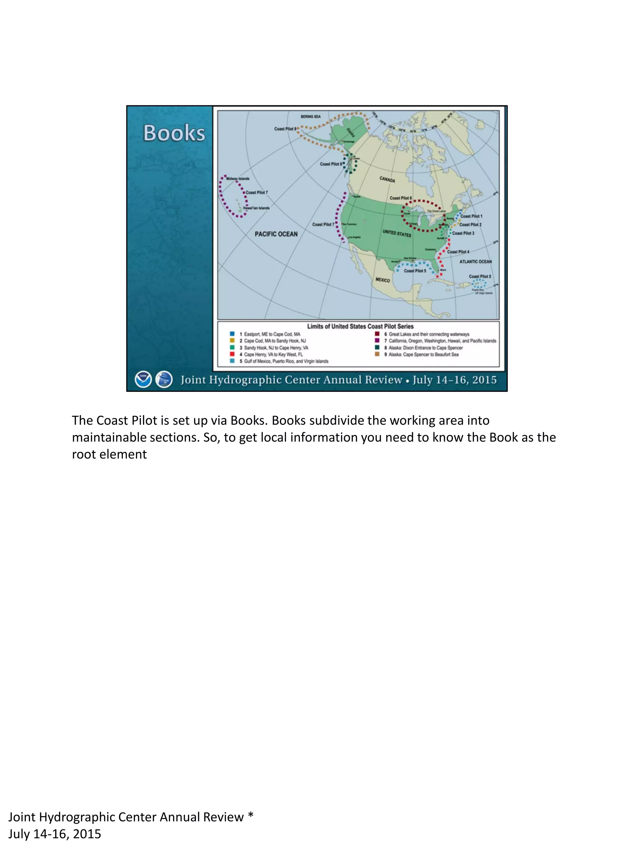

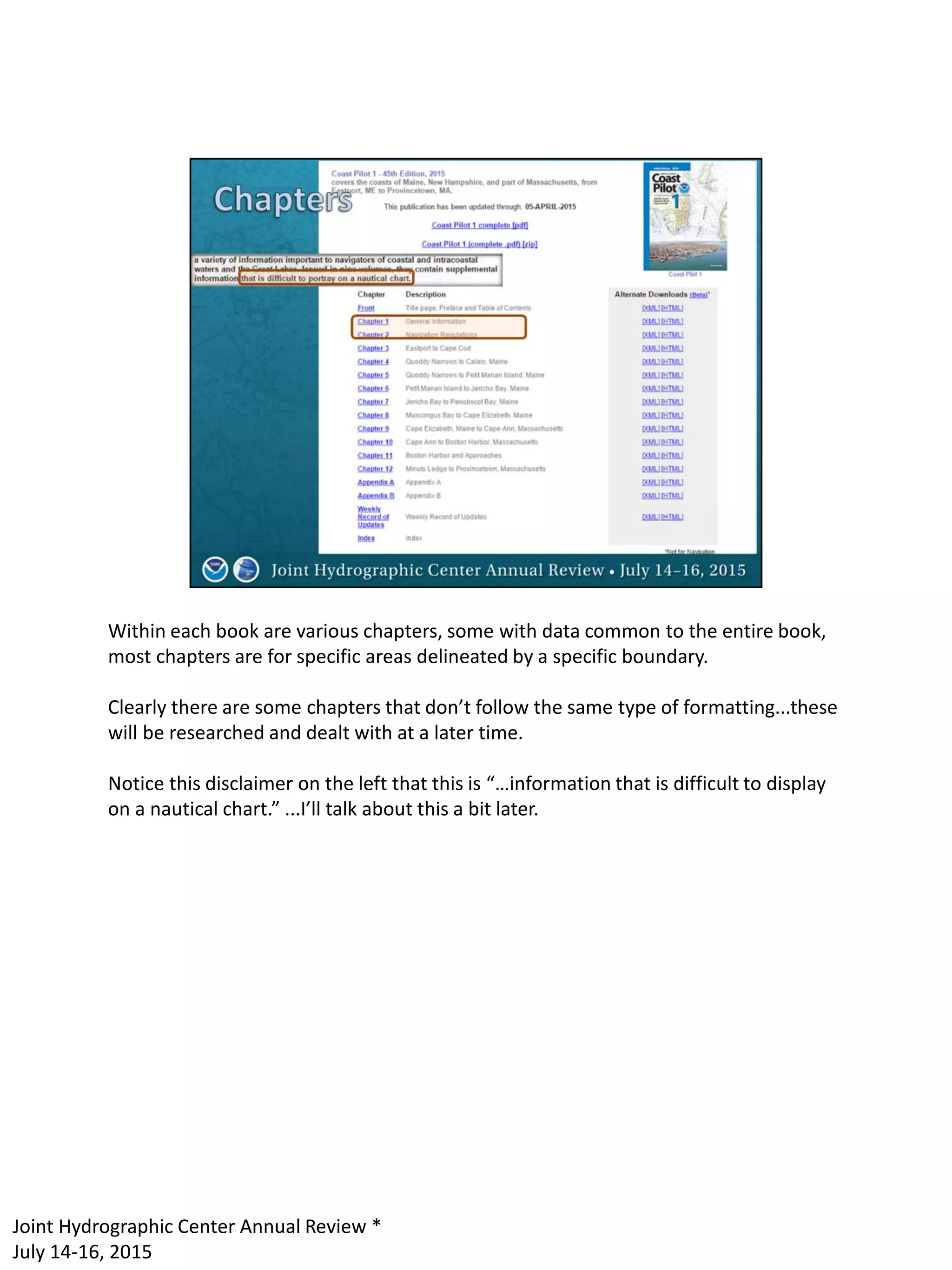
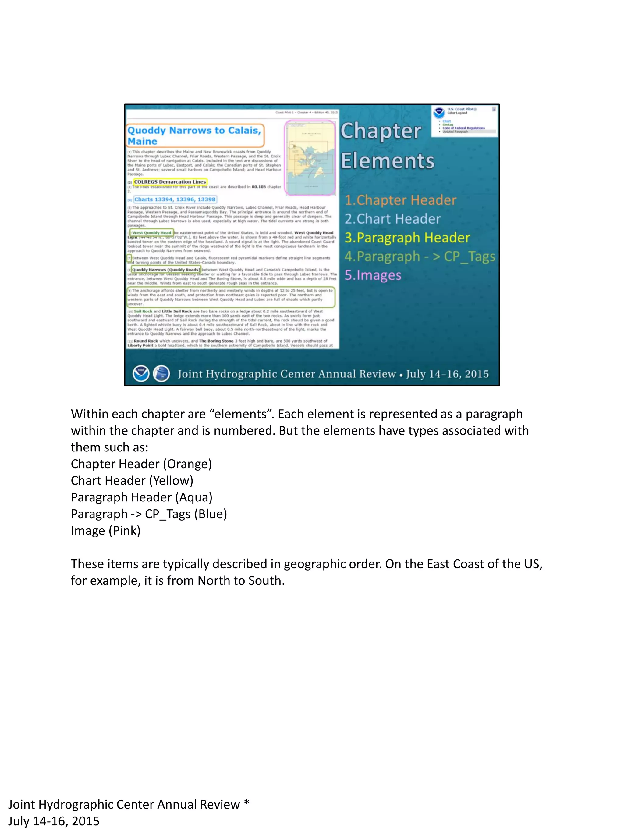

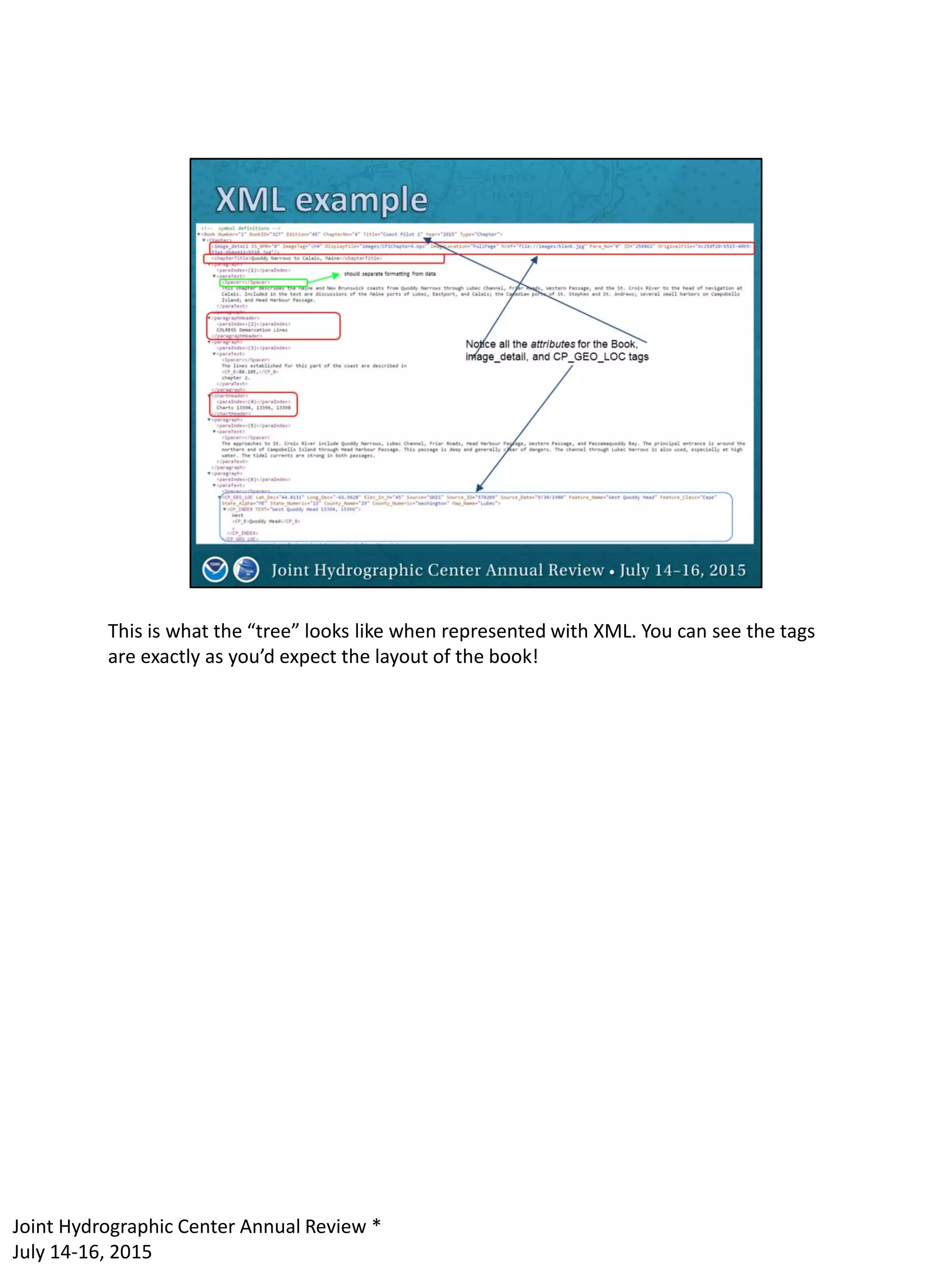

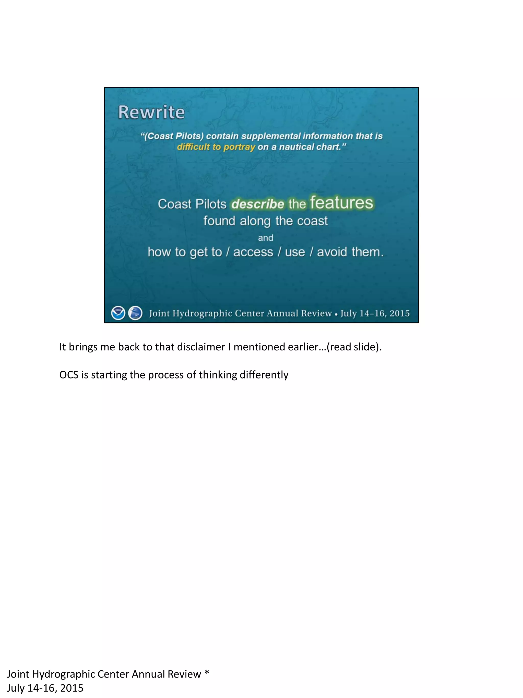
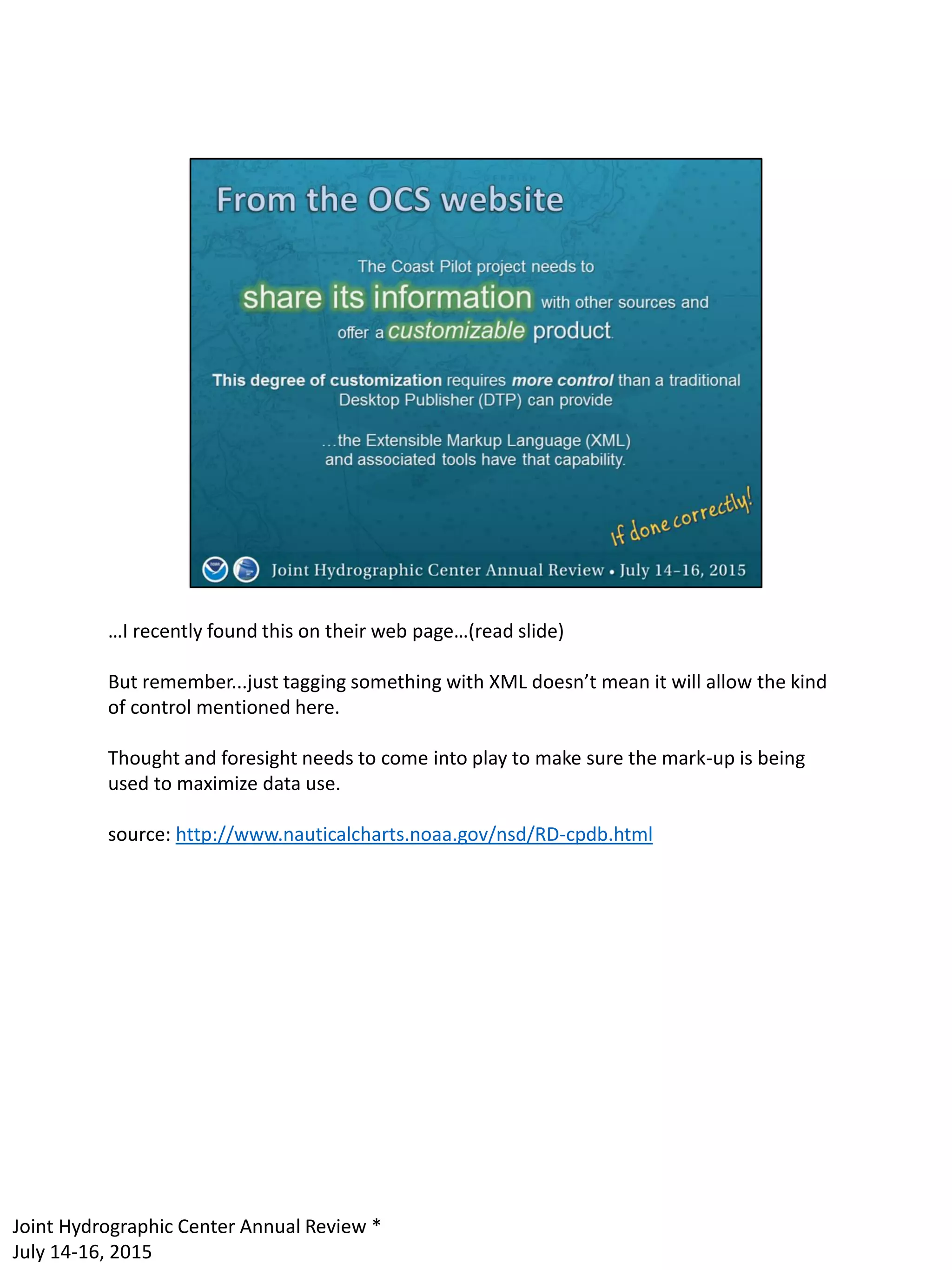
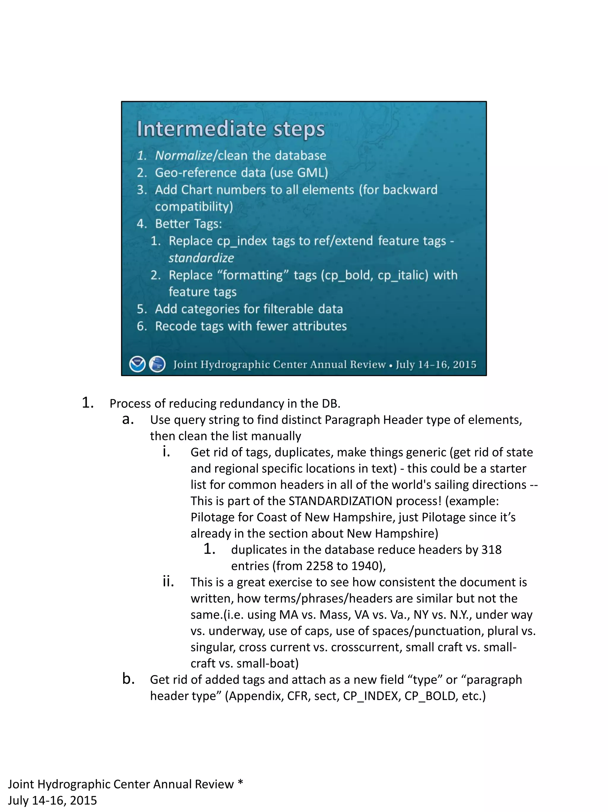


Briana Sullivan presents ideas for improving the data structure of Coast Pilot information. Currently it is organized hierarchically by book, chapter and paragraph, but information about individual geographic features is spread across the text. Briana proposes tagging the text with XML to extract all information about each feature in one place. This would allow features to be linked to nautical charts and make the data more usable for applications like Google Maps. Implementing this change would be a large undertaking, but smaller interim steps could standardize headers and geo-reference some text.