DSD-INT 2025 3D Modeling of Shallow Water Dynamics Using Delft3D FM - Martins
Presentation by Cicero Martins Jr. (University of Palermo, Italy) at the Delft3D User Days, during the Delft Software Days - Edition 2025 (DSD-INT 2025). Monday, 10 November 2025, Delft.
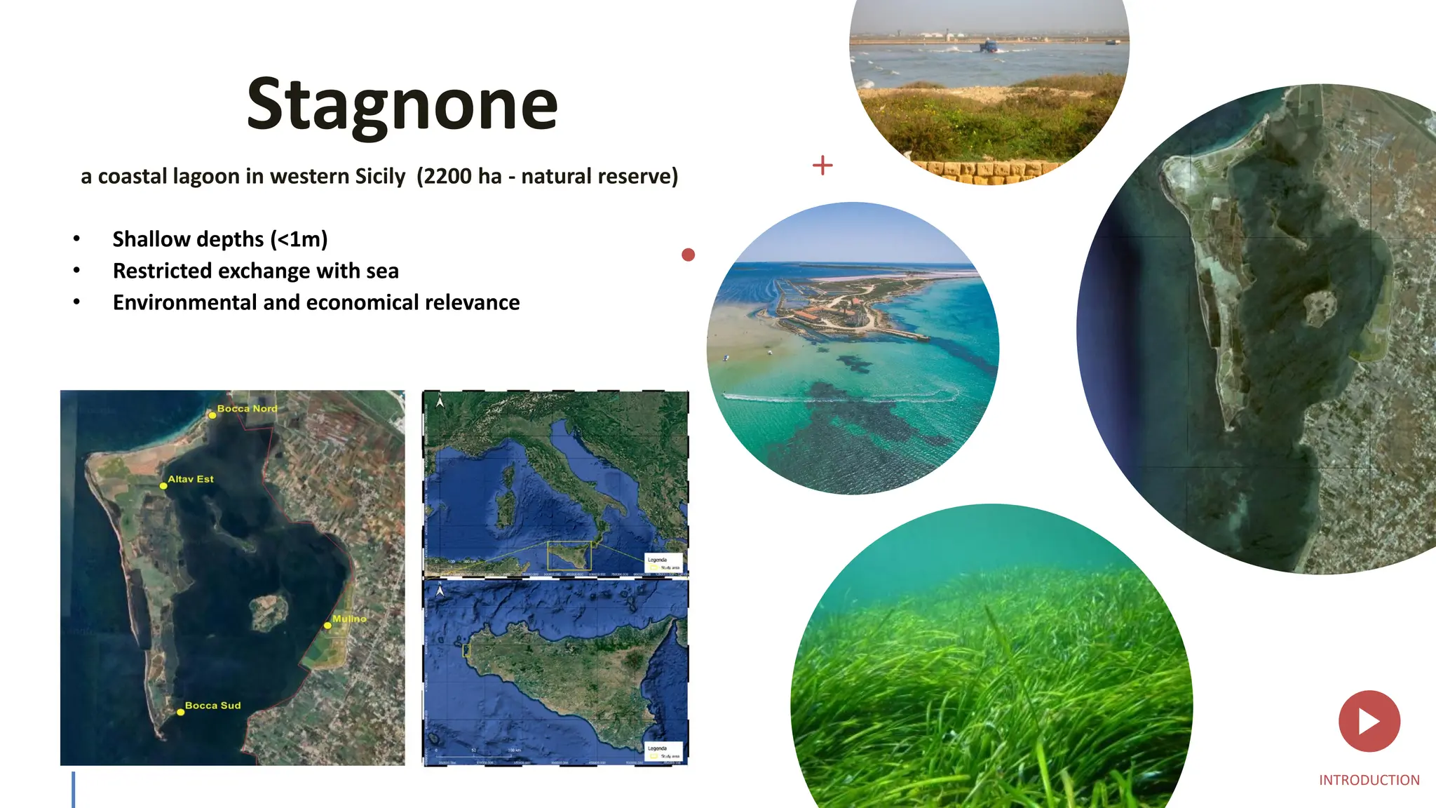
Stagnone
a coastal lagoonin western Sicily (2200 ha - natural reserve)
• Shallow depths (<1m)
• Restricted exchange with sea
• Environmental and economical relevance
INTRODUCTION
4.
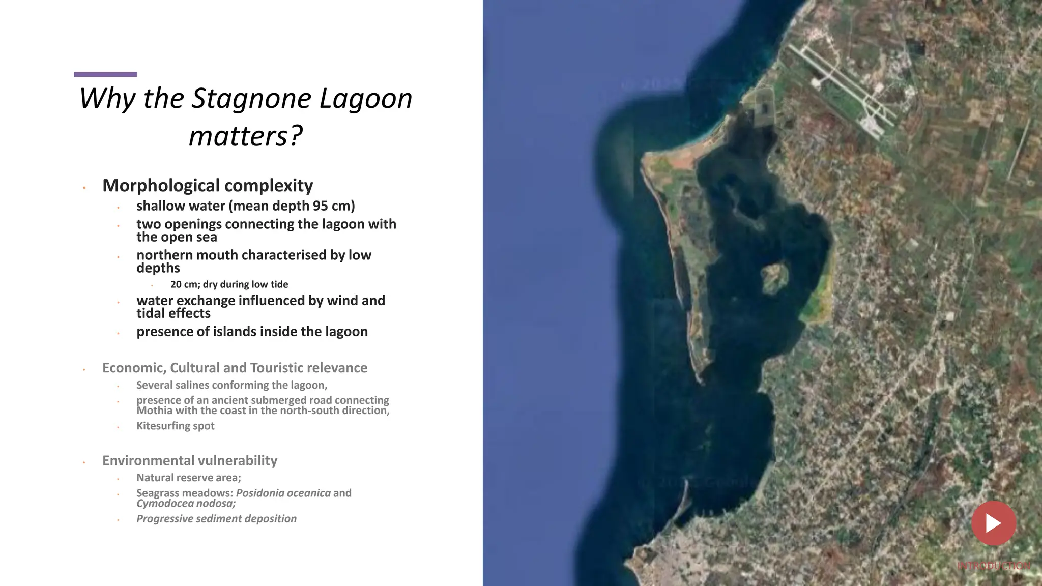
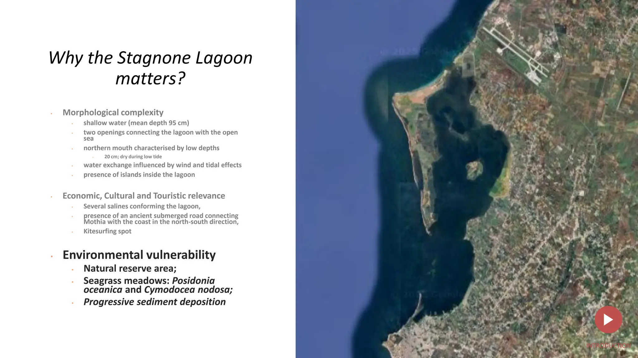
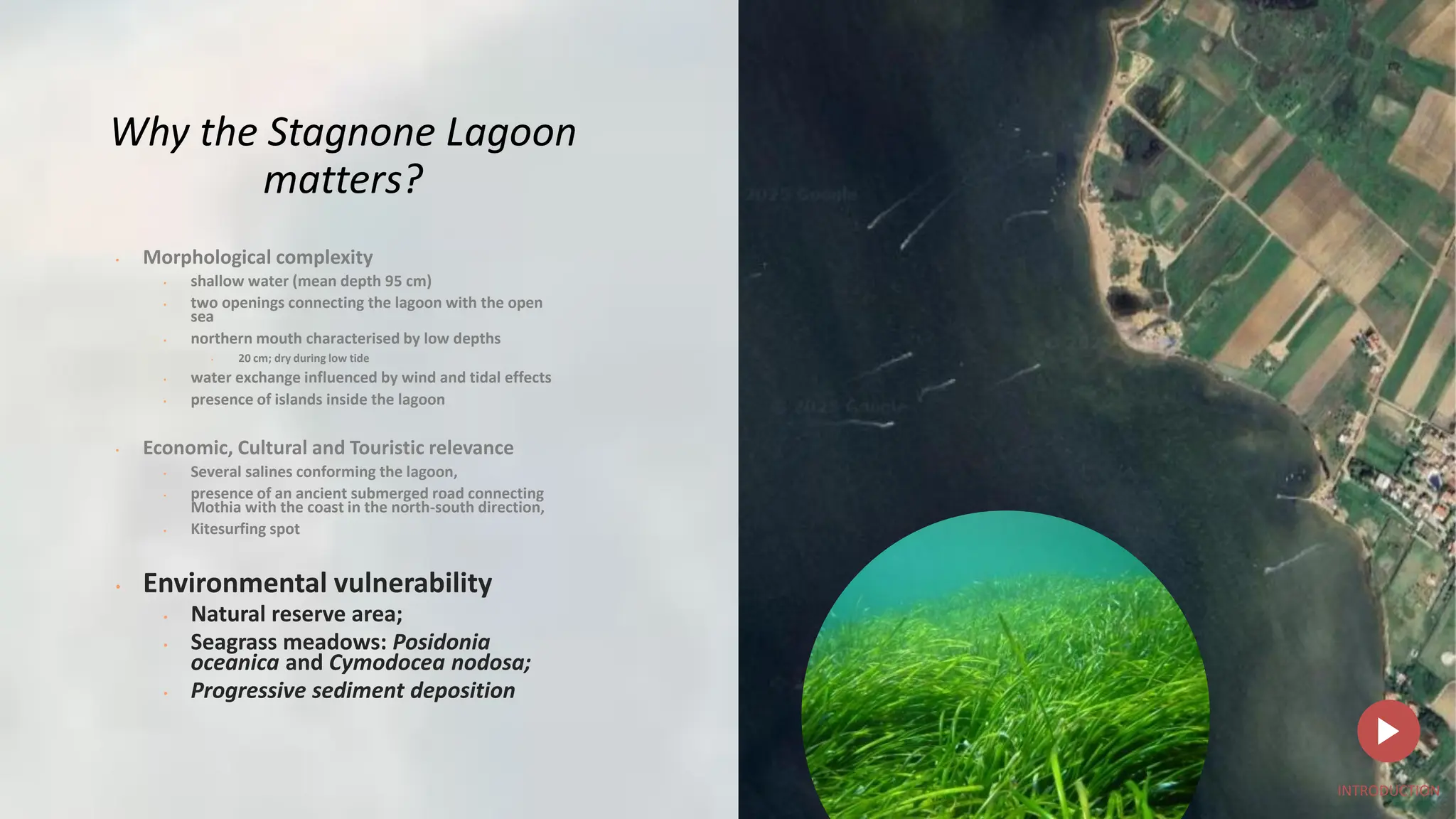
Why the StagnoneLagoon
matters?
• Morphological complexity
• shallow water (mean depth 95 cm)
• two openings connecting the lagoon with
the open sea
• northern mouth characterised by low
depths
• 20 cm; dry during low tide
• water exchange influenced by wind and
tidal effects
• presence of islands inside the lagoon
• Economic, Cultural and Touristic relevance
• Several salines conforming the lagoon,
• presence of an ancient submerged road connecting
Mothia with the coast in the north-south direction,
• Kitesurfing spot
• Environmental vulnerability
• Natural reserve area;
• Seagrass meadows: Posidonia oceanica and
Cymodocea nodosa;
• Progressive sediment deposition
INTRODUCTION
5.
z
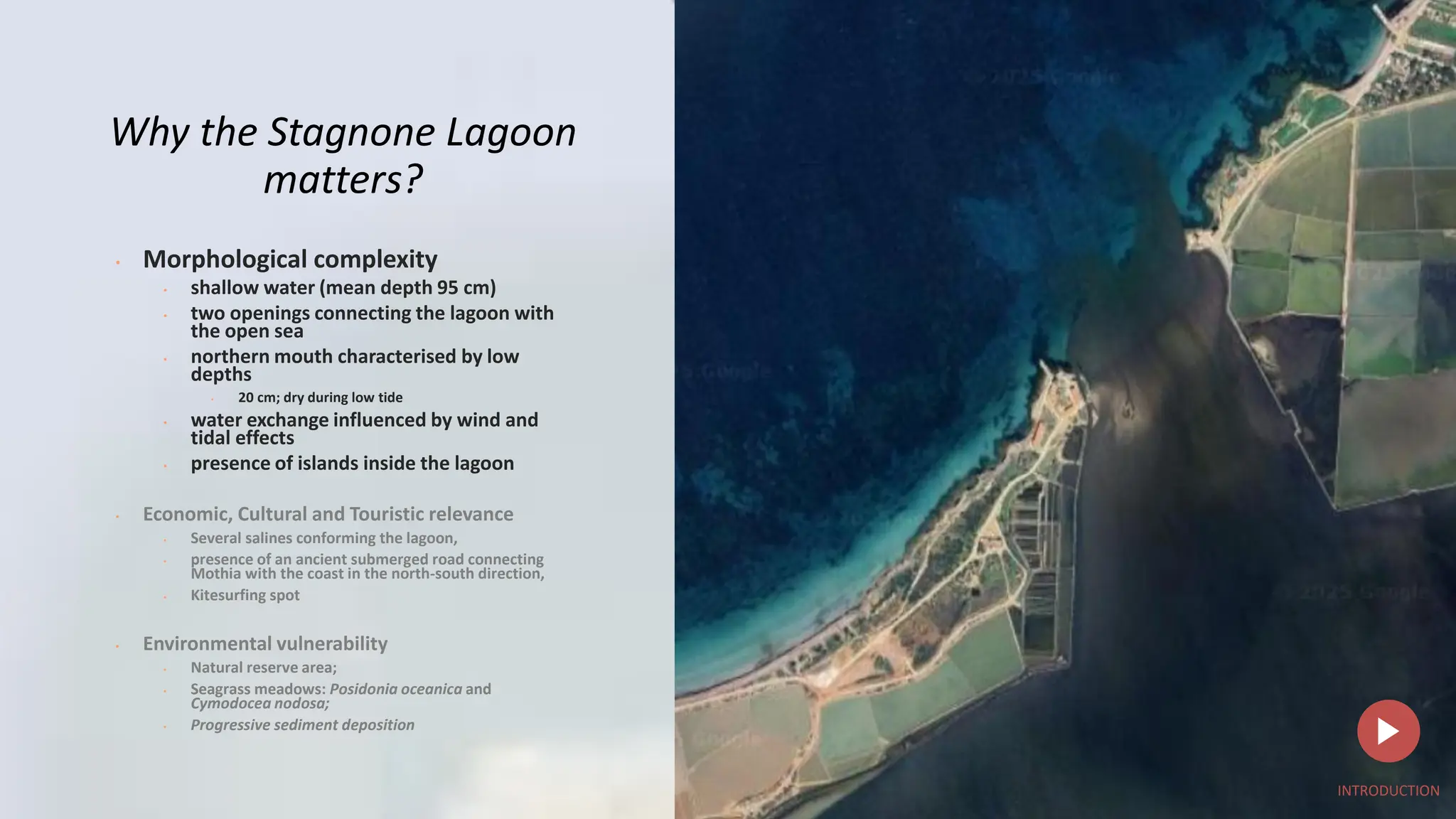
Why the StagnoneLagoon
matters?
• Morphological complexity
• shallow water (mean depth 95 cm)
• two openings connecting the lagoon with
the open sea
• northern mouth characterised by low
depths
• 20 cm; dry during low tide
• water exchange influenced by wind and
tidal effects
• presence of islands inside the lagoon
• Economic, Cultural and Touristic relevance
• Several salines conforming the lagoon,
• presence of an ancient submerged road connecting
Mothia with the coast in the north-south direction,
• Kitesurfing spot
• Environmental vulnerability
• Natural reserve area;
• Seagrass meadows: Posidonia oceanica and
Cymodocea nodosa;
• Progressive sediment deposition
INTRODUCTION
6.
•
Why the StagnoneLagoon
matters?
• Morphological complexity
• shallow water (mean depth 95 cm)
• two openings connecting the lagoon with the open
sea
• northern mouth characterised by low depths
• 20 cm; dry during low tide
• water exchange influenced by wind and tidal effects
• presence of islands inside the lagoon
• Economic, Cultural and Touristic
relevance
• Several salines conforming the lagoon,
• presence of an ancient submerged road
connecting Mothia with the coast in the
north-south direction,
• Kitesurfing spot
• Environmental vulnerability
• Natural reserve area;
• Seagrass meadows: Posidonia oceanica and
Cymodocea nodosa;
• Progressive sediment deposition
INTRODUCTION
7.
z
•
Why the StagnoneLagoon
matters?
• Morphological complexity
• shallow water (mean depth 95 cm)
• two openings connecting the lagoon with the open
sea
• northern mouth characterised by low depths
• 20 cm; dry during low tide
• water exchange influenced by wind and tidal effects
• presence of islands inside the lagoon
• Economic, Cultural and Touristic
relevance
• Several salines conforming the lagoon,
• presence of an ancient submerged road
connecting Mothia with the coast in the
north-south direction,
• Kitesurfing spot
• Environmental vulnerability
• Natural reserve area;
• Seagrass meadows: Posidonia oceanica and
Cymodocea nodosa;
• Progressive sediment deposition
INTRODUCTION
8.
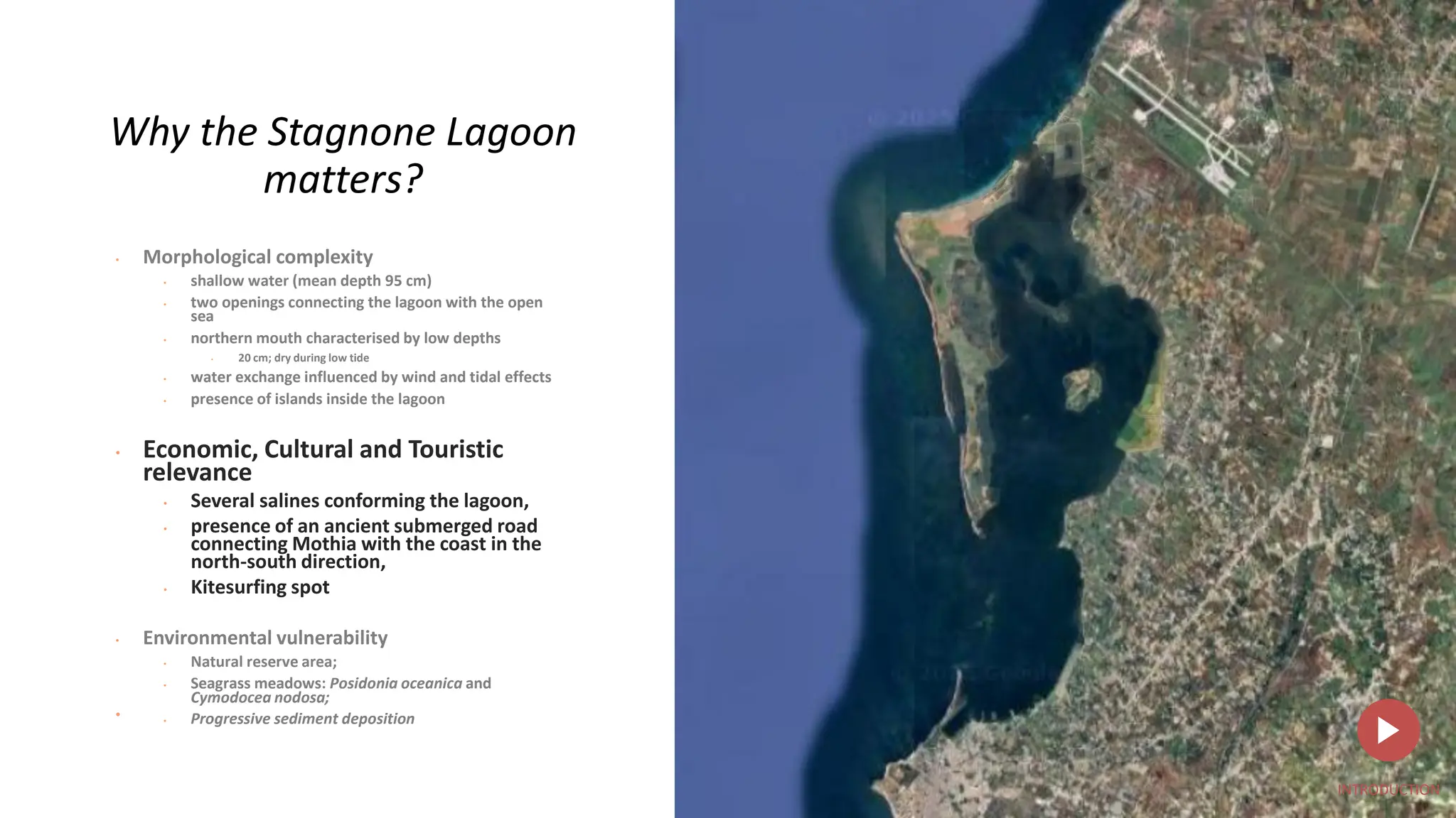
Why the StagnoneLagoon
matters?
• Morphological complexity
• shallow water (mean depth 95 cm)
• two openings connecting the lagoon with the open
sea
• northern mouth characterised by low depths
• 20 cm; dry during low tide
• water exchange influenced by wind and tidal effects
• presence of islands inside the lagoon
• Economic, Cultural and Touristic relevance
• Several salines conforming the lagoon,
• presence of an ancient submerged road connecting
Mothia with the coast in the north-south direction,
• Kitesurfing spot
• Environmental vulnerability
• Natural reserve area;
• Seagrass meadows: Posidonia
oceanica and Cymodocea nodosa;
• Progressive sediment deposition
INTRODUCTION
9.
Why the StagnoneLagoon
matters?
• Morphological complexity
• shallow water (mean depth 95 cm)
• two openings connecting the lagoon with the open
sea
• northern mouth characterised by low depths
• 20 cm; dry during low tide
• water exchange influenced by wind and tidal effects
• presence of islands inside the lagoon
• Economic, Cultural and Touristic relevance
• Several salines conforming the lagoon,
• presence of an ancient submerged road connecting
Mothia with the coast in the north-south direction,
• Kitesurfing spot
• Environmental vulnerability
• Natural reserve area;
• Seagrass meadows: Posidonia
oceanica and Cymodocea nodosa;
• Progressive sediment deposition
INTRODUCTION
10.
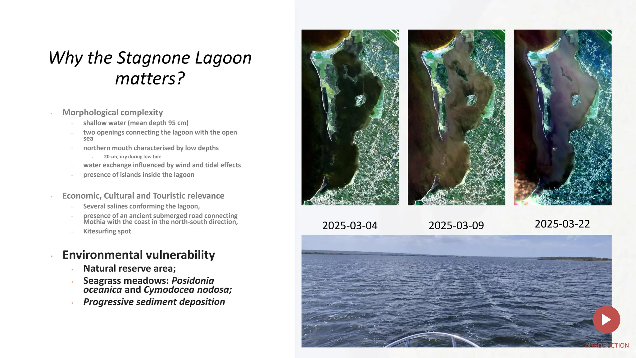
2025-03-04 2025-03-09 2025-03-22
Whythe Stagnone Lagoon
matters?
• Morphological complexity
• shallow water (mean depth 95 cm)
• two openings connecting the lagoon with the open
sea
• northern mouth characterised by low depths
• 20 cm; dry during low tide
• water exchange influenced by wind and tidal effects
• presence of islands inside the lagoon
• Economic, Cultural and Touristic relevance
• Several salines conforming the lagoon,
• presence of an ancient submerged road connecting
Mothia with the coast in the north-south direction,
• Kitesurfing spot
• Environmental vulnerability
• Natural reserve area;
• Seagrass meadows: Posidonia
oceanica and Cymodocea nodosa;
• Progressive sediment deposition
INTRODUCTION
11.
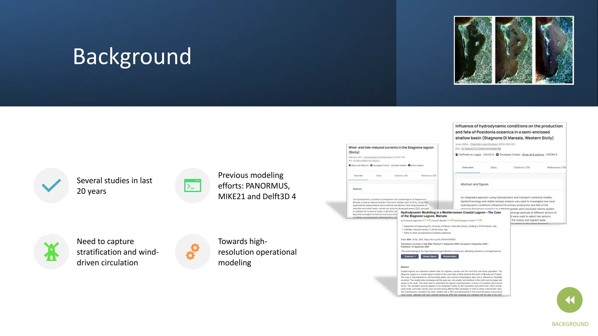
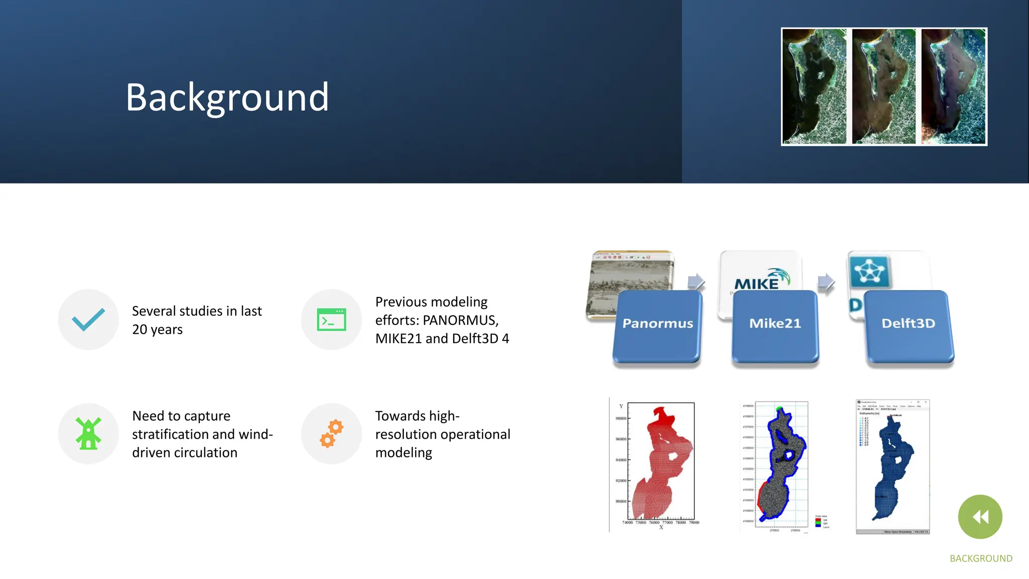
Background
Several studies inlast
20 years
Previous modeling
efforts: PANORMUS,
MIKE21 and Delft3D 4
Need to capture
stratification and wind-
driven circulation
Towards high-
resolution operational
modeling
BACKGROUND
12.
Background
Several studies inlast
20 years
Previous modeling
efforts: PANORMUS,
MIKE21 and Delft3D 4
Need to capture
stratification and wind-
driven circulation
Towards high-
resolution operational
modeling
BACKGROUND
13.
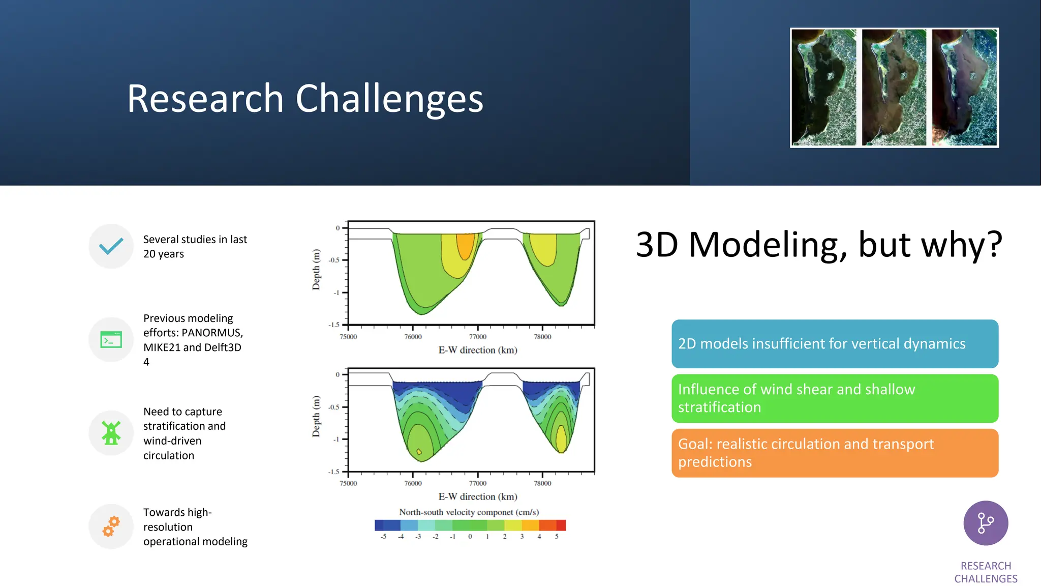
Research Challenges
Several studiesin last
20 years
Previous modeling
efforts: PANORMUS,
MIKE21 and Delft3D
4
Need to capture
stratification and
wind-driven
circulation
Towards high-
resolution
operational modeling
3D Modeling, but why?
2D models insufficient for vertical dynamics
Influence of wind shear and shallow
stratification
Goal: realistic circulation and transport
predictions
RESEARCH
CHALLENGES
14.
Research Challenges
Several studiesin last
20 years
Previous modeling
efforts: PANORMUS,
MIKE21 and Delft3D
4
Need to capture
stratification and
wind-driven
circulation
Towards high-
resolution
operational modeling
RESEARCH
CHALLENGES
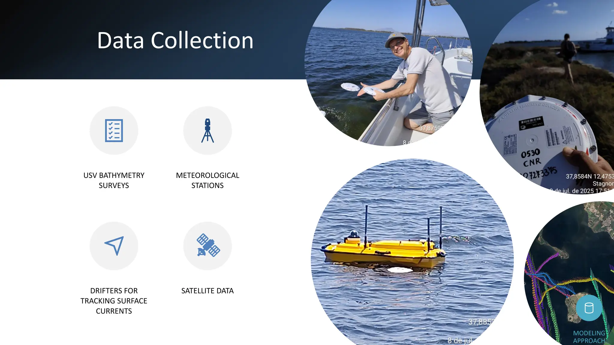
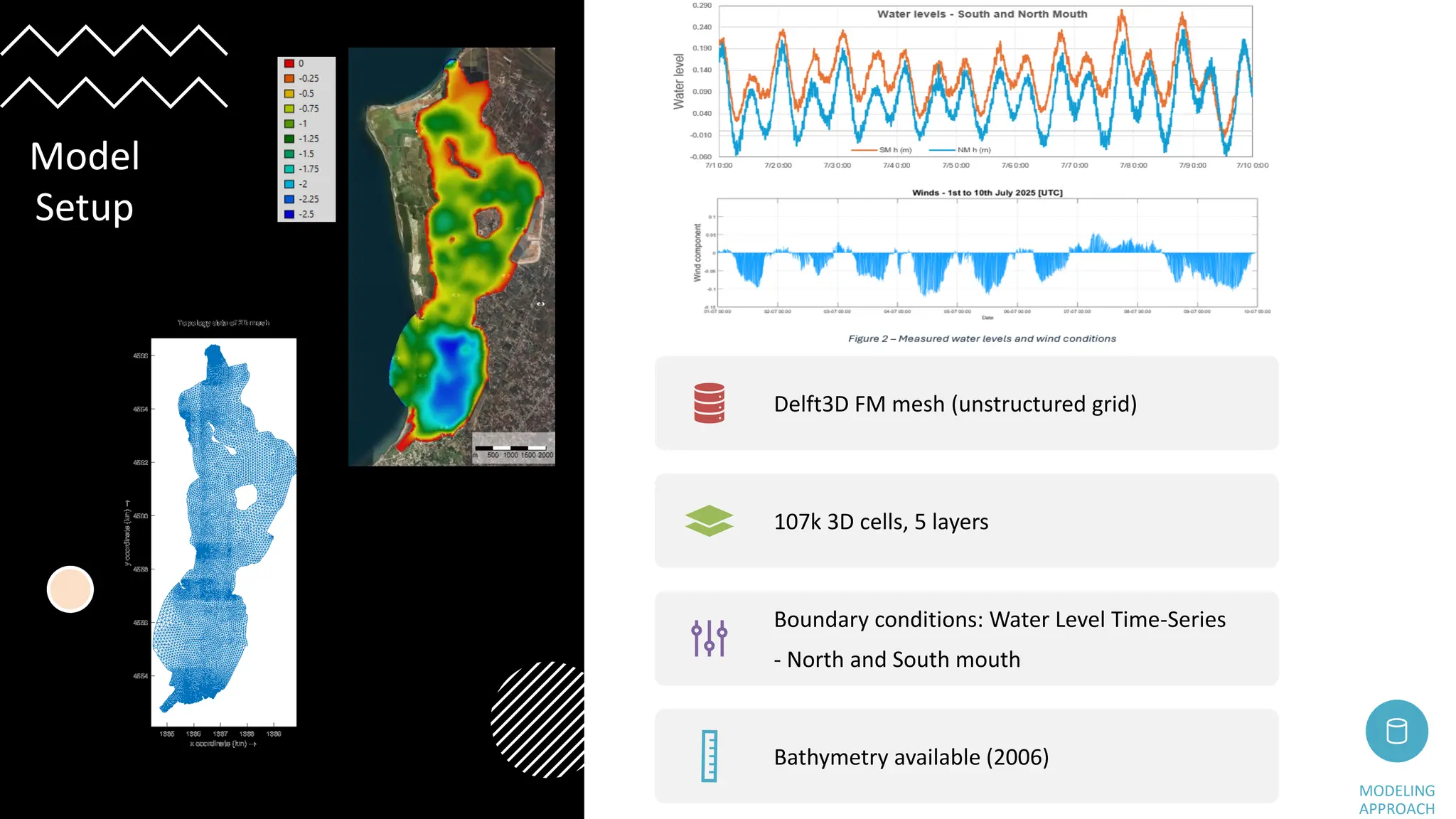
Delft3D FM mesh(unstructured grid)
107k 3D cells, 5 layers
Boundary conditions: Water Level Time-Series
- North and South mouth
Bathymetry available (2006)
MODELING
APPROACH
Model
Setup
17.
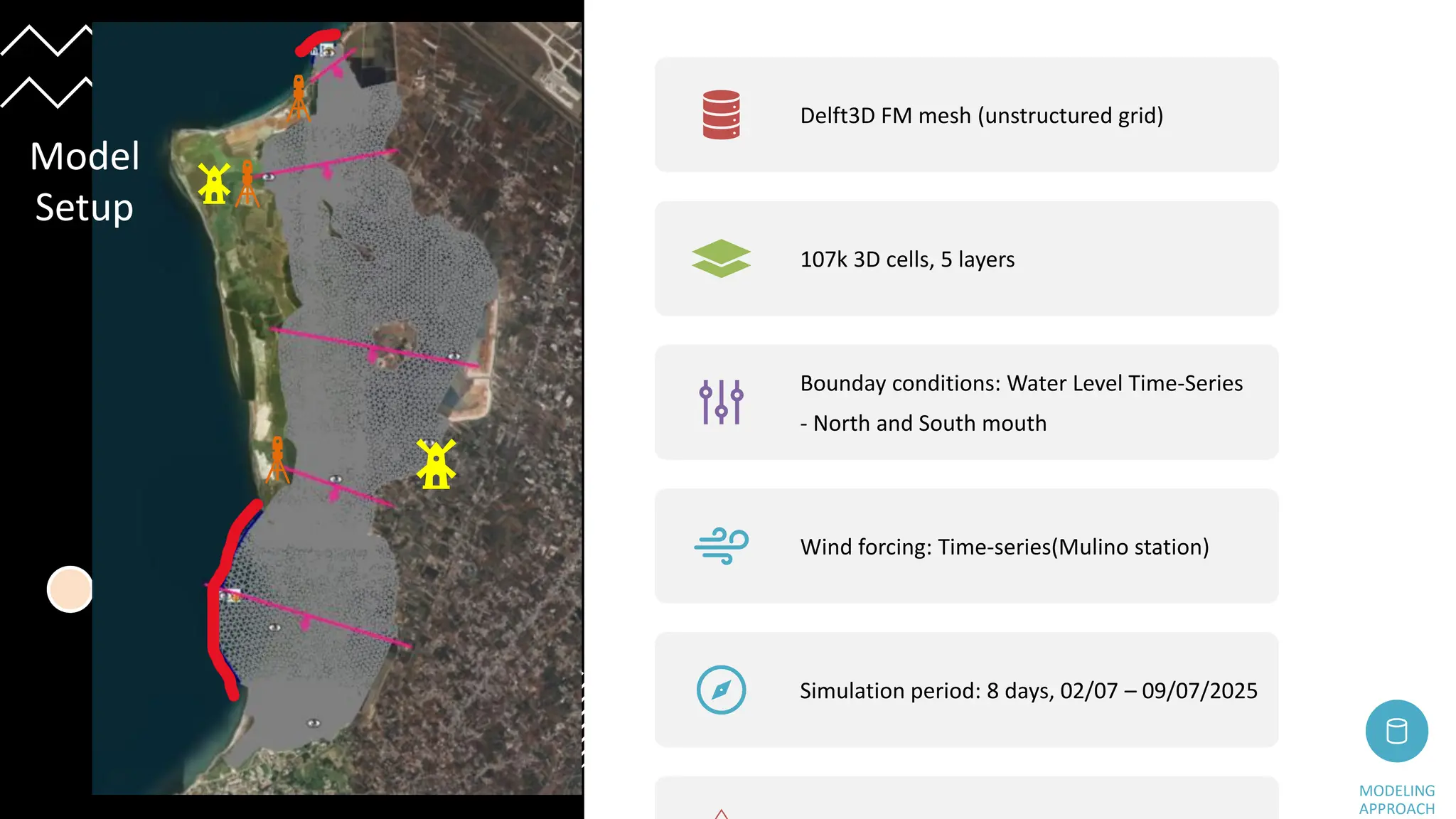
Delft3D FM mesh(unstructured grid)
107k 3D cells, 5 layers
Bounday conditions: Water Level Time-Series
- North and South mouth
Wind forcing: Time-series(Mulino station)
Simulation period: 8 days, 02/07 – 09/07/2025
MODELING
APPROACH
Model
Setup
18.
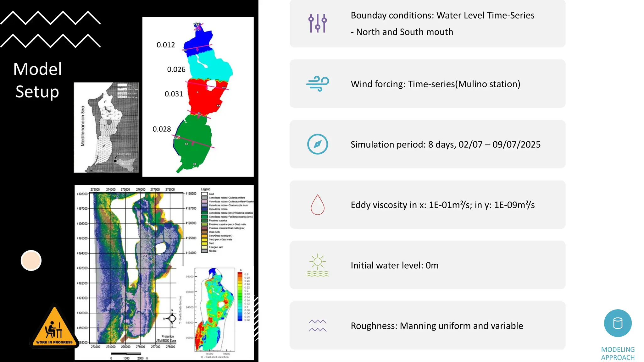
Bounday conditions: WaterLevel Time-Series
- North and South mouth
Wind forcing: Time-series(Mulino station)
Simulation period: 8 days, 02/07 – 09/07/2025
Eddy viscosity in x: 1E-01m²/s; in y: 1E-09m²/s
Initial water level: 0m
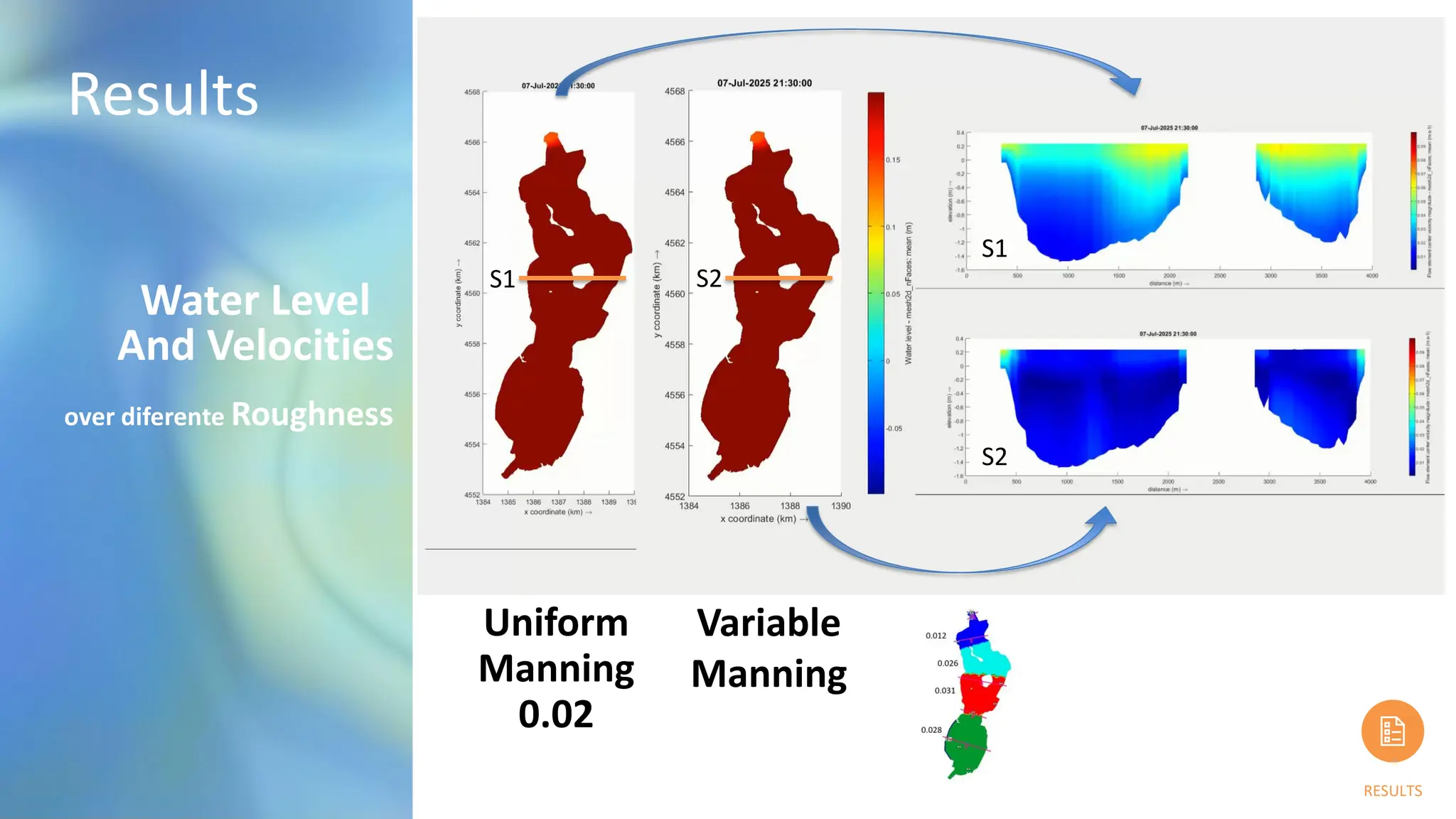
Roughness: Manning uniform and variable
MODELING
APPROACH
Model
Setup
0.012
0.026
0.031
0.028
19.
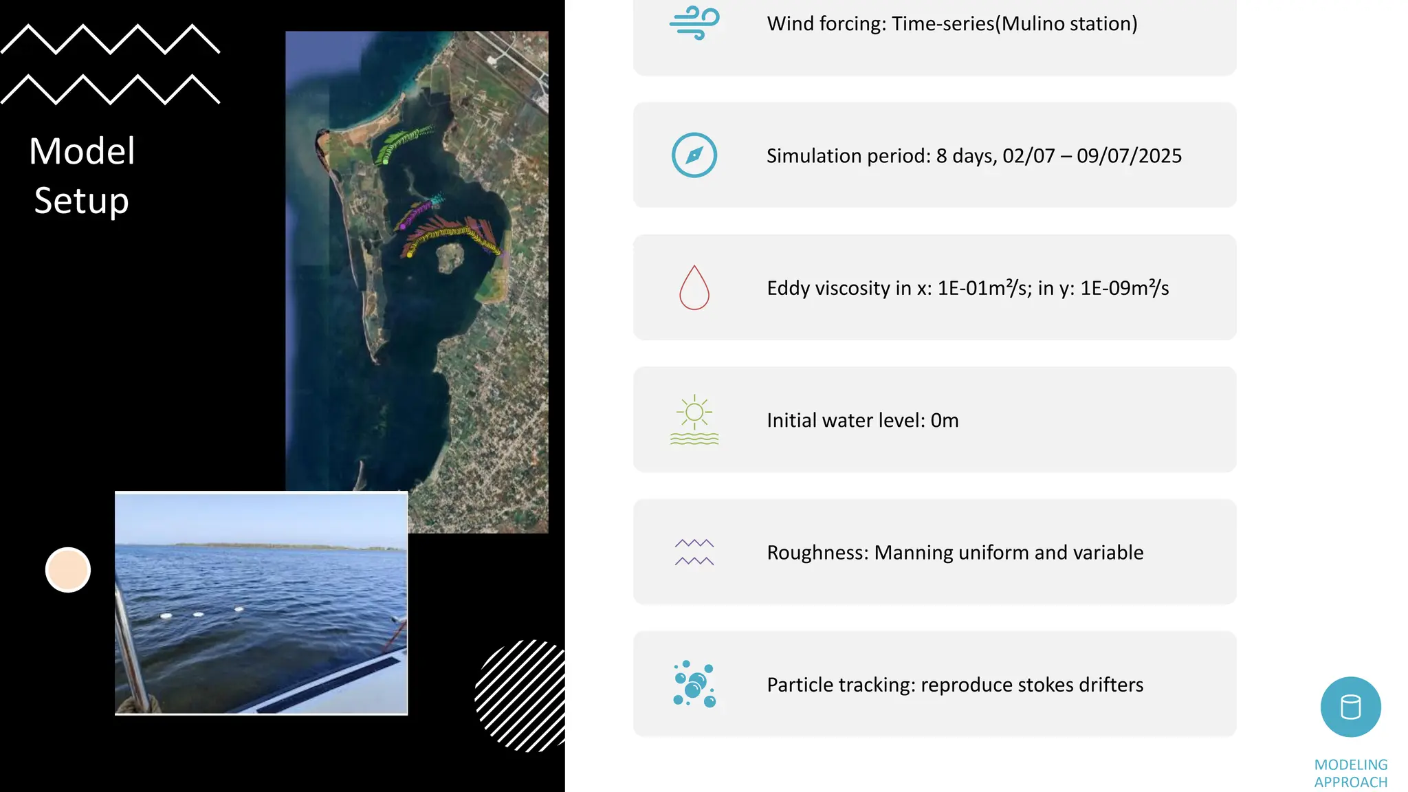
Wind forcing: Time-series(Mulinostation)
Simulation period: 8 days, 02/07 – 09/07/2025
Eddy viscosity in x: 1E-01m²/s; in y: 1E-09m²/s
Initial water level: 0m
Roughness: Manning uniform and variable
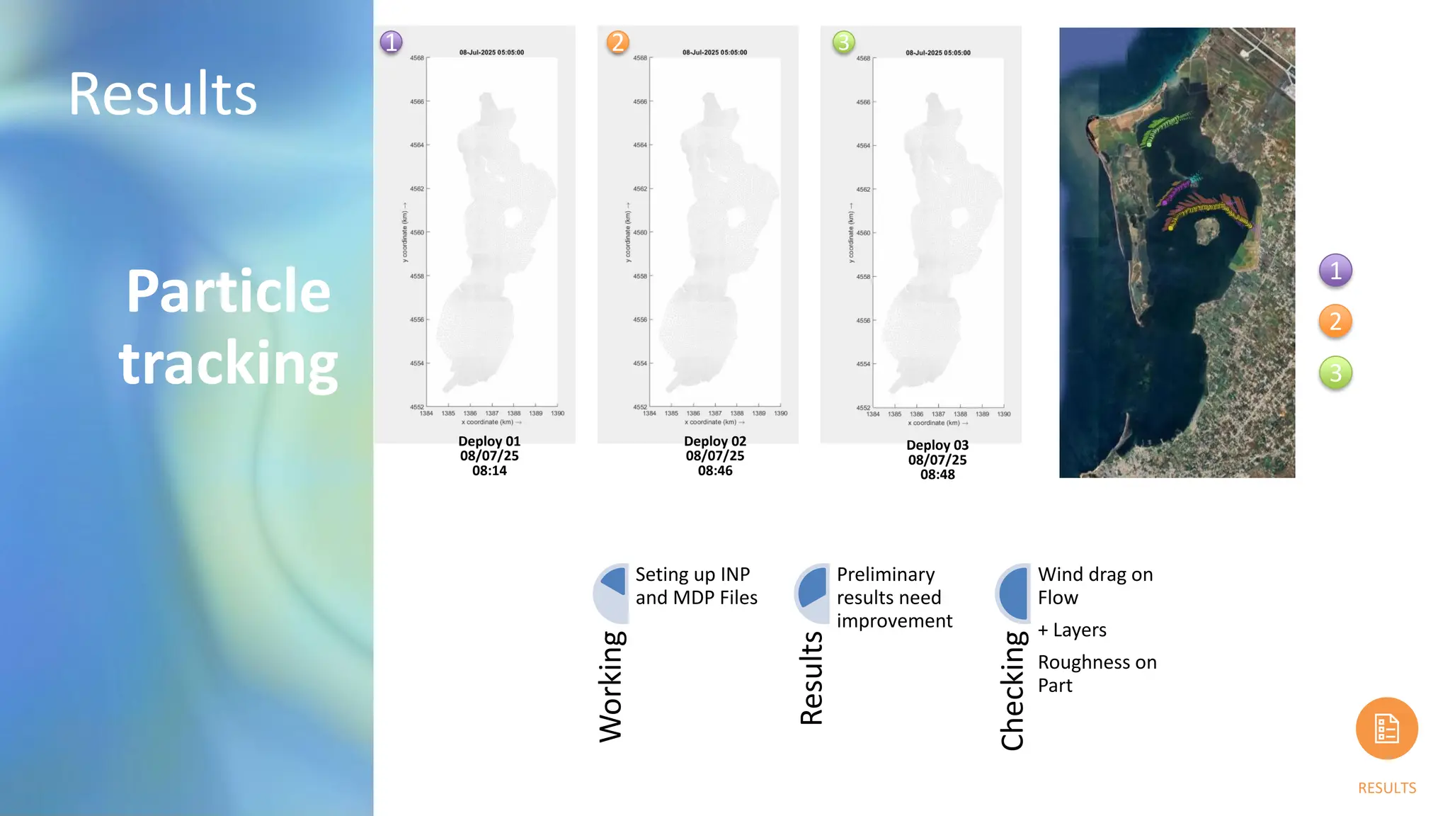
Particle tracking: reproduce stokes drifters
MODELING
APPROACH
Model
Setup
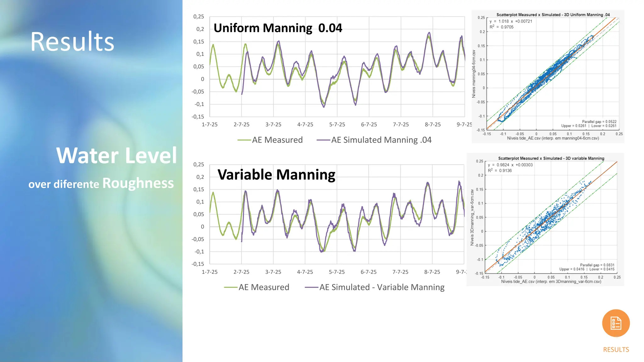
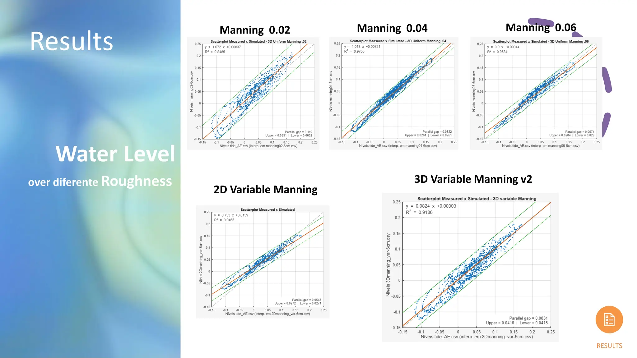
Results
RESULTS
Particle
tracking
Working
Seting up INP
andMDP Files
Results
Preliminary
results need
improvement
Checking
Wind drag on
Flow
+ Layers
Roughness on
Part
Deploy 01
08/07/25
08:14
Deploy 02
08/07/25
08:46
Deploy 03
08/07/25
08:48
1
2
3
1 2 3
24.
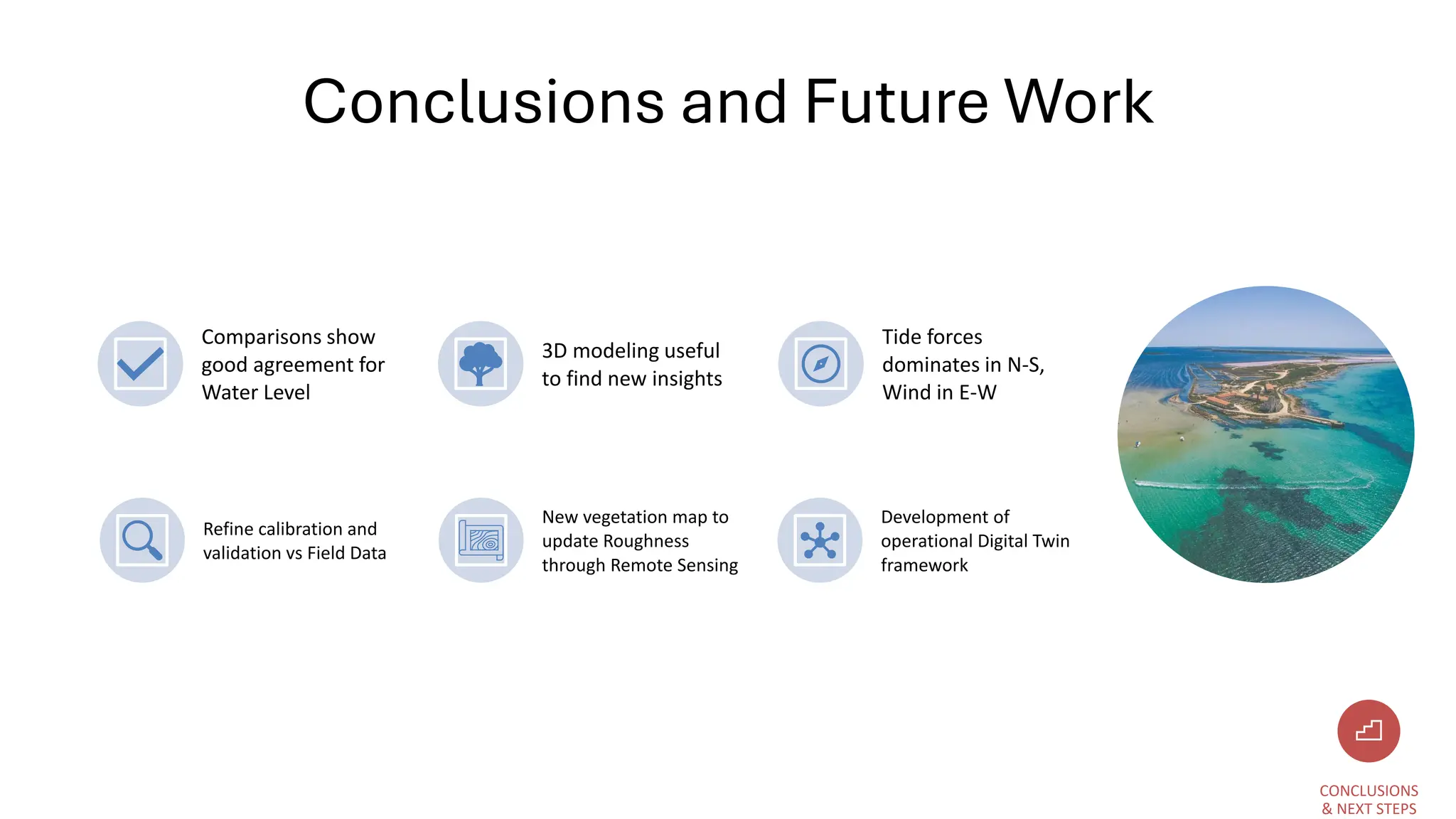
Conclusions and FutureWork
Refine calibration and
validation vs Field Data
New vegetation map to
update Roughness
through Remote Sensing
Development of
operational Digital Twin
framework
CONCLUSIONS
& NEXT STEPS
Comparisons show
good agreement for
Water Level
3D modeling useful
to find new insights
Tide forces
dominates in N-S,
Wind in E-W