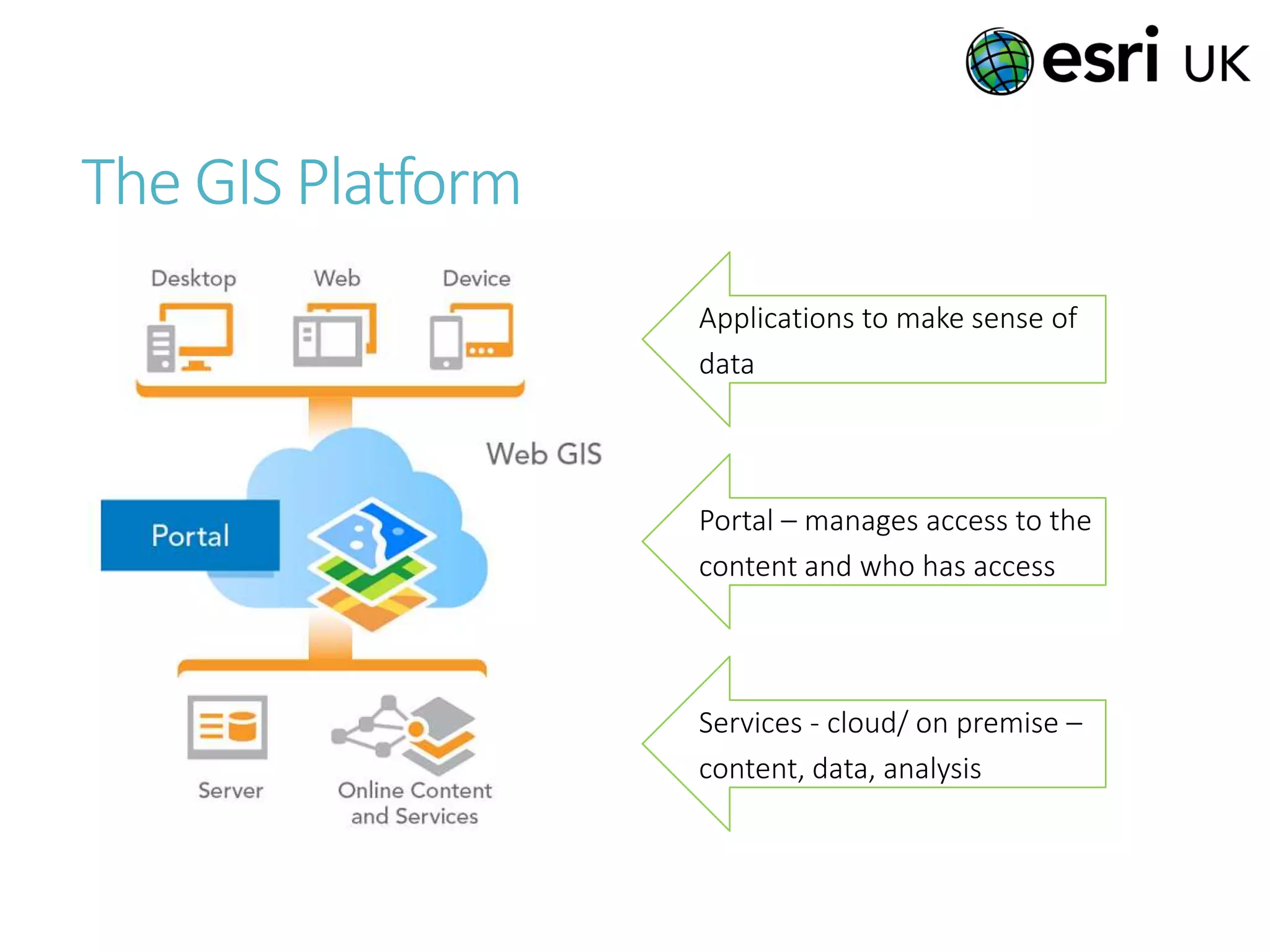
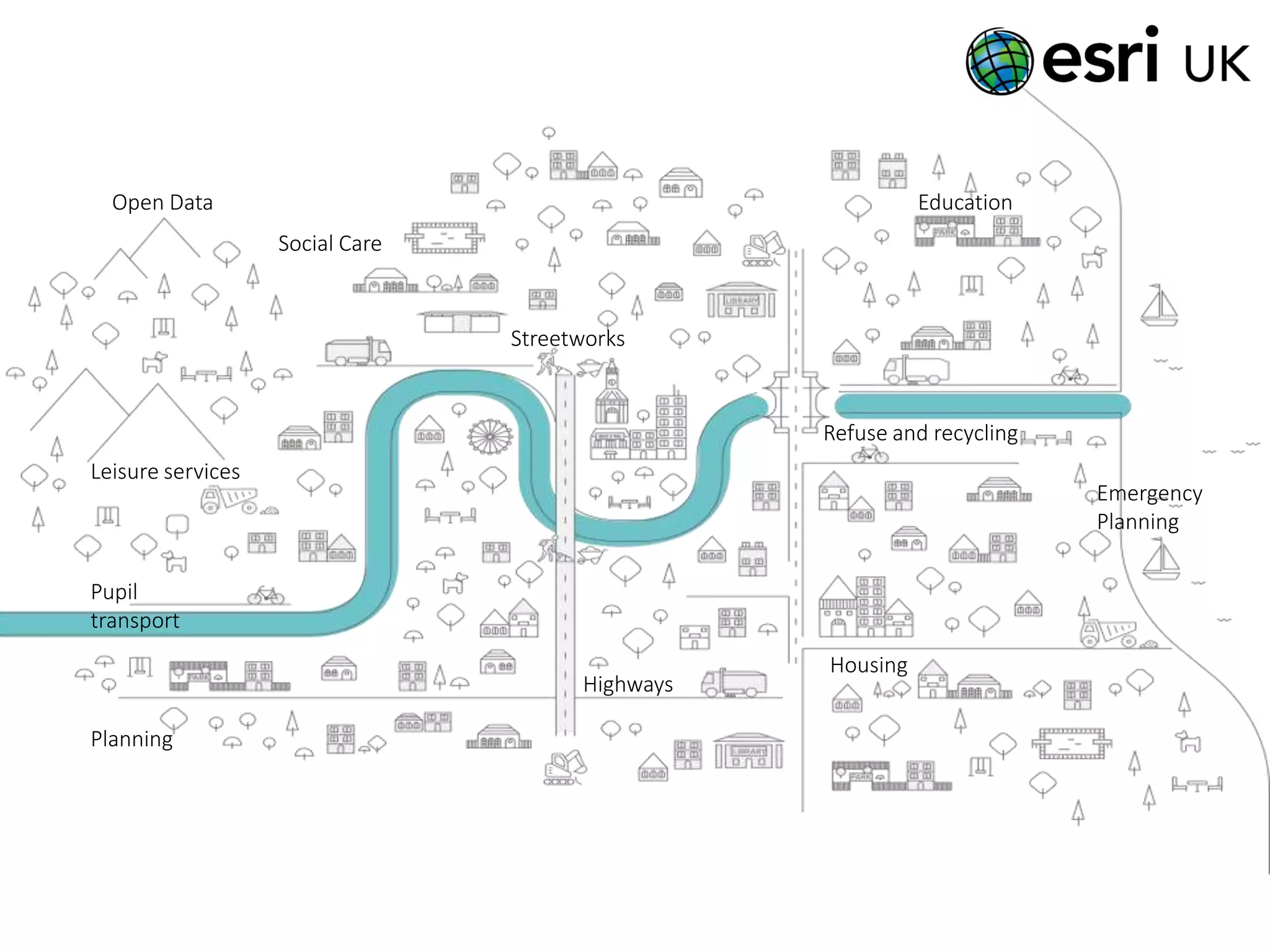
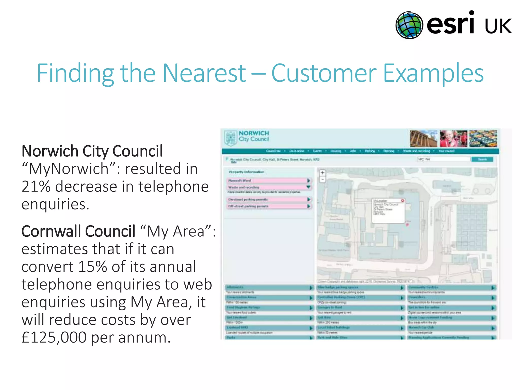
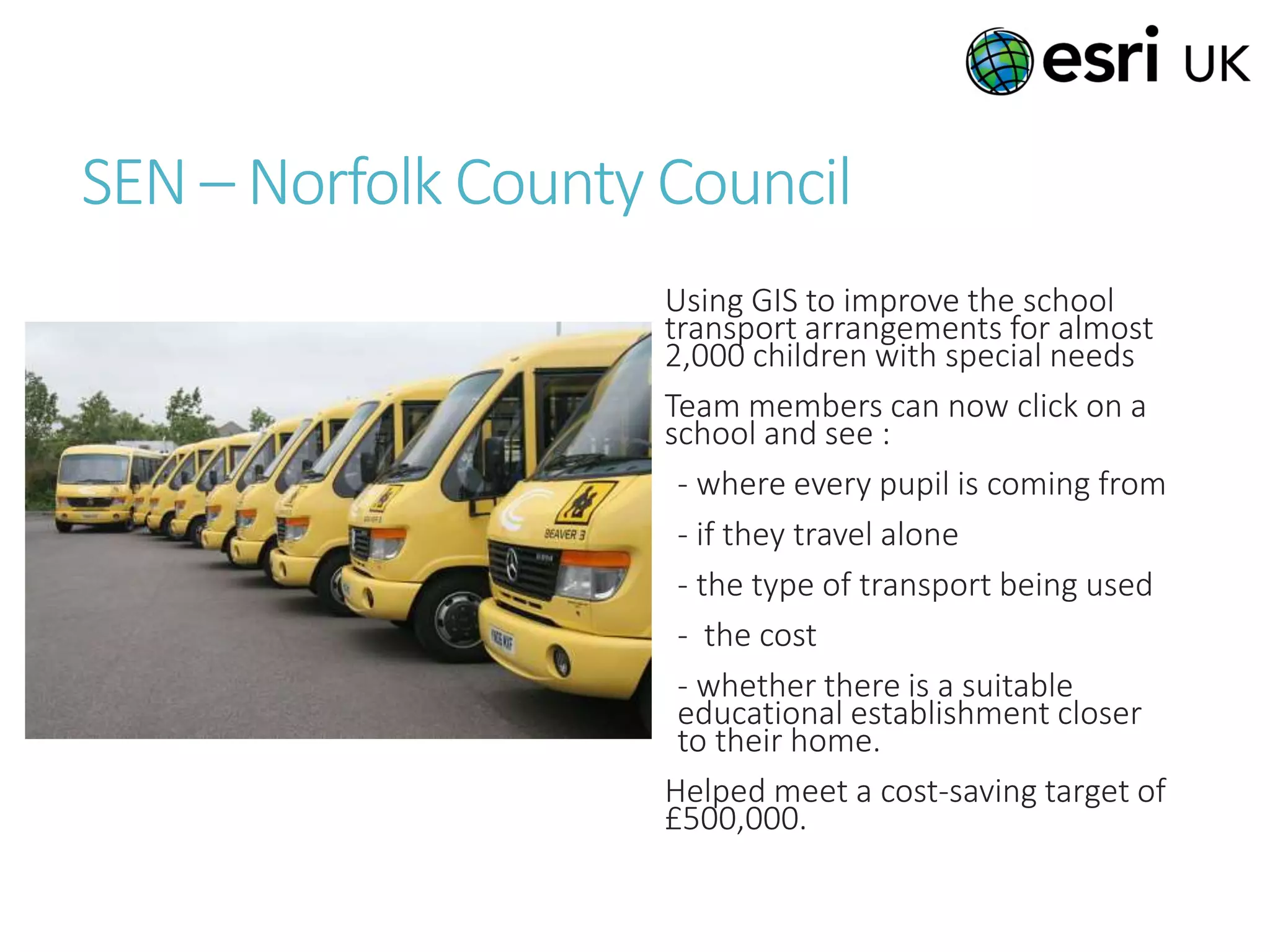
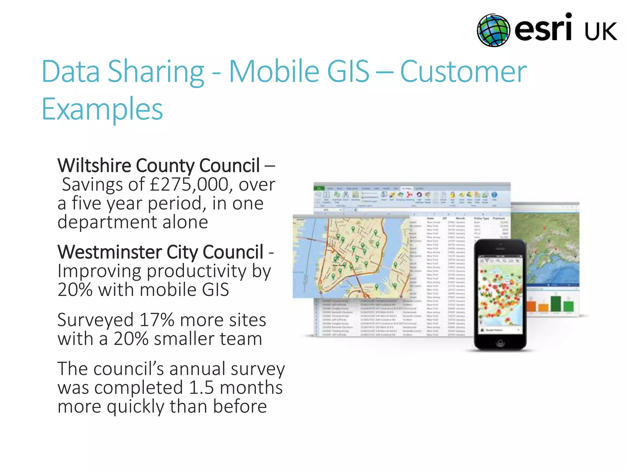
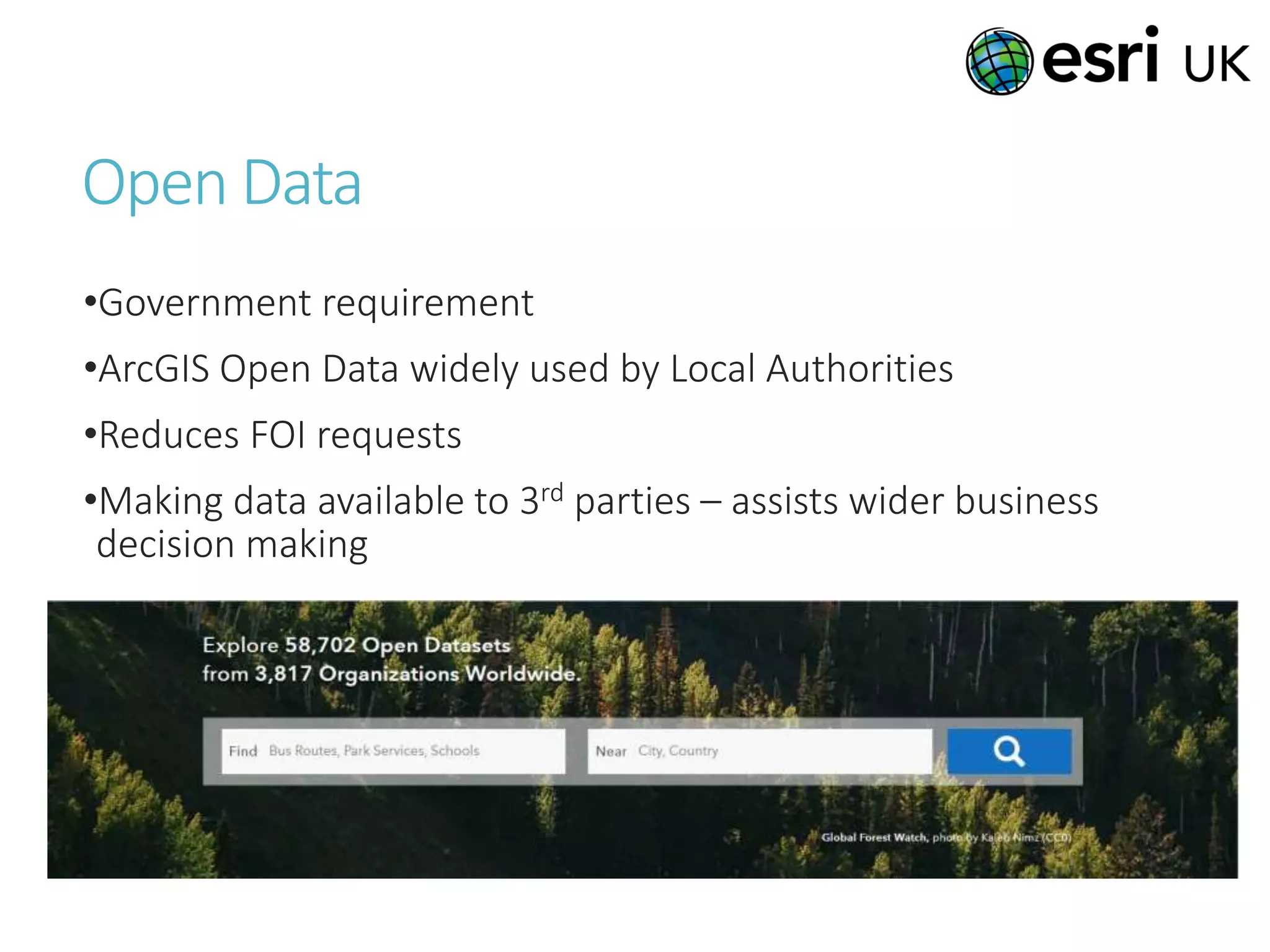
Using GIS to Inform
Business Decisions
Wednesday 8th March 2016
Claire Inkpen – Esri UK
Who are Esri and Esri UK?
“ ArcGIS […] has enabled us to
create user-friendly mobile
solutions that start to save money,
improve our efficiency and deliver
better information to citizens
straight away ”
Andrew Gardener – GIS Officer, Epping Forest District Council
More than points on a map…
GIS allows you to…
Establish the
best route
…and more!
View &
Compare
patterns over
time
Understand
what the
nearest
features are
Calculate
underlying
values
Determine an
optimum
location
Record asset
information
Consider
multiple
variables in
decision
making
Store and share
geographical
data
GIS – A system of record
Identify features
within a target area
Perform comparative
time-based analytics
Create thematic maps Show clusters and
hotspots
Answer what-if
scenarios
Find a route from A to
B considering
impedances
Locations
CCTV Coverage
Building Plans
Assets
Road Network
Woodland
Geology/Soils
Terrain
Properties
Census Data
Health Statistics
Utility Networks
Policy Holders
Land Ownership
Flood Risk
Rivers/Canals
The GIS Platform
Applications to make sense of
data
Portal – manages access to the
content and who has access
Services - cloud/ on premise –
content, data, analysis
Housing
Refuse and recycling
Highways
Planning
Leisure services
Education
Pupil
transport
Streetworks
Emergency
Planning
Open Data
Social Care
Finding the Nearest – Customer Examples
Norwich City Council
“MyNorwich”: resulted in
21% decrease in telephone
enquiries.
Cornwall Council “My Area”:
estimates that if it can
convert 15% of its annual
telephone enquiries to web
enquiries using My Area, it
will reduce costs by over
£125,000 per annum.
SEN – Norfolk County Council
Using GIS to improve the school
transport arrangements for almost
2,000 children with special needs
Team members can now click on a
school and see :
- where every pupil is coming from
- if they travel alone
- the type of transport being used
- the cost
- whether there is a suitable
educational establishment closer
to their home.
Helped meet a cost-saving target of
£500,000.
Data Sharing - Mobile GIS – Customer
Examples
Wiltshire County Council –
Savings of £275,000, over
a five year period, in one
department alone
Westminster City Council -
Improving productivity by
20% with mobile GIS
Surveyed 17% more sites
with a 20% smaller team
The council’s annual survey
was completed 1.5 months
more quickly than before
Open Data
•Government requirement
•ArcGIS Open Data widely used by Local Authorities
•Reduces FOI requests
•Making data available to 3rd parties – assists wider business
decision making
Everything exists
somewhere U
P
R
N
“The application of GIS
is limited only by the
imagination of those
who use it”.
Jack Dangermond, Esri
Claire Inkpen
Email: cinkpen@esriuk.com
Phone: 01296 745554
Mobile: 07525 668821
https://uk.linkedin.com/in/claireinkpen

Exploiting Spatial Data to Inform Business Transformation - Claire Inkpen

  • 1.
    Using GIS toInform Business Decisions Wednesday 8th March 2016 Claire Inkpen – Esri UK
  • 2.
    Who are Esriand Esri UK?
  • 3.
    “ ArcGIS […]has enabled us to create user-friendly mobile solutions that start to save money, improve our efficiency and deliver better information to citizens straight away ” Andrew Gardener – GIS Officer, Epping Forest District Council
  • 4.
    More than pointson a map… GIS allows you to… Establish the best route …and more! View & Compare patterns over time Understand what the nearest features are Calculate underlying values Determine an optimum location Record asset information Consider multiple variables in decision making Store and share geographical data
  • 5.
    GIS – Asystem of record Identify features within a target area Perform comparative time-based analytics Create thematic maps Show clusters and hotspots Answer what-if scenarios Find a route from A to B considering impedances Locations CCTV Coverage Building Plans Assets Road Network Woodland Geology/Soils Terrain Properties Census Data Health Statistics Utility Networks Policy Holders Land Ownership Flood Risk Rivers/Canals
  • 6.
    The GIS Platform Applicationsto make sense of data Portal – manages access to the content and who has access Services - cloud/ on premise – content, data, analysis
  • 7.
    Housing Refuse and recycling Highways Planning Leisureservices Education Pupil transport Streetworks Emergency Planning Open Data Social Care
  • 8.
    Finding the Nearest– Customer Examples Norwich City Council “MyNorwich”: resulted in 21% decrease in telephone enquiries. Cornwall Council “My Area”: estimates that if it can convert 15% of its annual telephone enquiries to web enquiries using My Area, it will reduce costs by over £125,000 per annum.
  • 9.
    SEN – NorfolkCounty Council Using GIS to improve the school transport arrangements for almost 2,000 children with special needs Team members can now click on a school and see : - where every pupil is coming from - if they travel alone - the type of transport being used - the cost - whether there is a suitable educational establishment closer to their home. Helped meet a cost-saving target of £500,000.
  • 10.
    Data Sharing -Mobile GIS – Customer Examples Wiltshire County Council – Savings of £275,000, over a five year period, in one department alone Westminster City Council - Improving productivity by 20% with mobile GIS Surveyed 17% more sites with a 20% smaller team The council’s annual survey was completed 1.5 months more quickly than before
  • 11.
    Open Data •Government requirement •ArcGISOpen Data widely used by Local Authorities •Reduces FOI requests •Making data available to 3rd parties – assists wider business decision making
  • 12.
  • 13.
    “The application ofGIS is limited only by the imagination of those who use it”. Jack Dangermond, Esri
  • 14.
    Claire Inkpen Email: cinkpen@esriuk.com Phone:01296 745554 Mobile: 07525 668821 https://uk.linkedin.com/in/claireinkpen

Editor's Notes

  • #6 On one hand, GIS can be complex – On left: many layers creating a representation of the real world The upside to this complexity is that we can derive insights from hard data about the locations and spatial relationships between all of these things These all represent data that could be relevant to your business On the right: some applications of GIS analysis But what to do? How to communicate and share with a range of users?