Download to read offline


![Indexing complex geospatial shapes
CREATE TABLE places(
id uuid PRIMARY KEY,
shape text -- WKT formatted
);
CREATE CUSTOM INDEX places_idx ON places()
USING 'com.stratio.cassandra.lucene.Index'
WITH OPTIONS = {
'schema': '{
fields: {
shape: {
type: "geo_shape",
max_levels: 15,
transformations: []
}
}
}'
};
• Points, lines, polygons & multiparts
• JTS index-time transformations
18/40](https://image.slidesharecdn.com/cassandrasummitusa2016slideshare-161102123738/75/Stratio-s-Cassandra-Lucene-index-Geospatial-use-cases-16-2048.jpg)
![CREATE CUSTOM INDEX places_idx ON places()
USING 'com.stratio.cassandra.lucene.Index'
WITH OPTIONS = {
'refresh_seconds': '1',
'schema': '{
fields: {
shape: {
type: "geo_shape",
max_levels: 15,
transformations: [{type: "centroid"}]
}
}
}'
};
Index-time shape transformations
• Example: Index only centroid of shapes
19/40](https://image.slidesharecdn.com/cassandrasummitusa2016slideshare-161102123738/75/Stratio-s-Cassandra-Lucene-index-Geospatial-use-cases-17-2048.jpg)
![Index-time shape transformations
• Example: Index 50 km buffer zone around shapes
CREATE CUSTOM INDEX places_idx ON places()
USING 'com.stratio.cassandra.lucene.Index'
WITH OPTIONS = {
'schema': '{
fields: {
shape: {
type: "geo_shape",
max_levels: 15,
transformations: [{
type: "buffer",
min_distance: "50km"}]
}
}
}'
};
20/40](https://image.slidesharecdn.com/cassandrasummitusa2016slideshare-161102123738/75/Stratio-s-Cassandra-Lucene-index-Geospatial-use-cases-18-2048.jpg)
![CREATE CUSTOM INDEX places_idx ON places()
USING 'com.stratio.cassandra.lucene.Index'
WITH OPTIONS = {
'refresh_seconds': '1',
'schema': '{
fields: {
shape: {
type: "geo_shape",
max_levels: 8,
transformations:
[{type: "convex_hull"}]
}
}
}'
};
Index-time shape transformations
• Example: Index the convex hull of the shape
21/40](https://image.slidesharecdn.com/cassandrasummitusa2016slideshare-161102123738/75/Stratio-s-Cassandra-Lucene-index-Geospatial-use-cases-19-2048.jpg)

![SELECT * FROM blocks WHERE expr(idx, '{
filter : {
type: "geo_shape",
field: "shape",
shape: {
type: "union",
shapes: [{
type: "convex_hull",
shape: {
type: "union",
shapes: [
{type: "buffer",
max_distance: "6mi",
shape: {value: "POINT(…)"}},
{type: "buffer",
max_distance: "3mi",
shape: {value: "POINT(…)"}}
]},
...
]
}
}}';
Use cases: Blocks affected by a moving hurricane](https://image.slidesharecdn.com/cassandrasummitusa2016slideshare-161102123738/75/Stratio-s-Cassandra-Lucene-index-Geospatial-use-cases-32-2048.jpg)


![Indexing complex geospatial shapes
CREATE TABLE places(
id uuid PRIMARY KEY,
shape text -- WKT formatted
);
CREATE CUSTOM INDEX places_idx ON places()
USING 'com.stratio.cassandra.lucene.Index'
WITH OPTIONS = {
'schema': '{
fields: {
shape: {
type: "geo_shape",
max_levels: 15,
transformations: []
}
}
}'
};
• Points, lines, polygons & multiparts
• JTS index-time transformations
18/40](https://crownmelresort.com/image.slidesharecdn.com/cassandrasummitusa2016slideshare-161102123738/75/Stratio-s-Cassandra-Lucene-index-Geospatial-use-cases-16-2048.jpg)
![CREATE CUSTOM INDEX places_idx ON places()
USING 'com.stratio.cassandra.lucene.Index'
WITH OPTIONS = {
'refresh_seconds': '1',
'schema': '{
fields: {
shape: {
type: "geo_shape",
max_levels: 15,
transformations: [{type: "centroid"}]
}
}
}'
};
Index-time shape transformations
• Example: Index only centroid of shapes
19/40](https://crownmelresort.com/image.slidesharecdn.com/cassandrasummitusa2016slideshare-161102123738/75/Stratio-s-Cassandra-Lucene-index-Geospatial-use-cases-17-2048.jpg)
![Index-time shape transformations
• Example: Index 50 km buffer zone around shapes
CREATE CUSTOM INDEX places_idx ON places()
USING 'com.stratio.cassandra.lucene.Index'
WITH OPTIONS = {
'schema': '{
fields: {
shape: {
type: "geo_shape",
max_levels: 15,
transformations: [{
type: "buffer",
min_distance: "50km"}]
}
}
}'
};
20/40](https://crownmelresort.com/image.slidesharecdn.com/cassandrasummitusa2016slideshare-161102123738/75/Stratio-s-Cassandra-Lucene-index-Geospatial-use-cases-18-2048.jpg)
![CREATE CUSTOM INDEX places_idx ON places()
USING 'com.stratio.cassandra.lucene.Index'
WITH OPTIONS = {
'refresh_seconds': '1',
'schema': '{
fields: {
shape: {
type: "geo_shape",
max_levels: 8,
transformations:
[{type: "convex_hull"}]
}
}
}'
};
Index-time shape transformations
• Example: Index the convex hull of the shape
21/40](https://crownmelresort.com/image.slidesharecdn.com/cassandrasummitusa2016slideshare-161102123738/75/Stratio-s-Cassandra-Lucene-index-Geospatial-use-cases-19-2048.jpg)


![SELECT * FROM blocks WHERE expr(idx, '{
filter : {
type: "geo_shape",
field: "shape",
shape: {
type: "union",
shapes: [{
type: "convex_hull",
shape: {
type: "union",
shapes: [
{type: "buffer",
max_distance: "6mi",
shape: {value: "POINT(…)"}},
{type: "buffer",
max_distance: "3mi",
shape: {value: "POINT(…)"}}
]},
...
]
}
}}';
Use cases: Blocks affected by a moving hurricane](https://crownmelresort.com/image.slidesharecdn.com/cassandrasummitusa2016slideshare-161102123738/75/Stratio-s-Cassandra-Lucene-index-Geospatial-use-cases-32-2048.jpg)


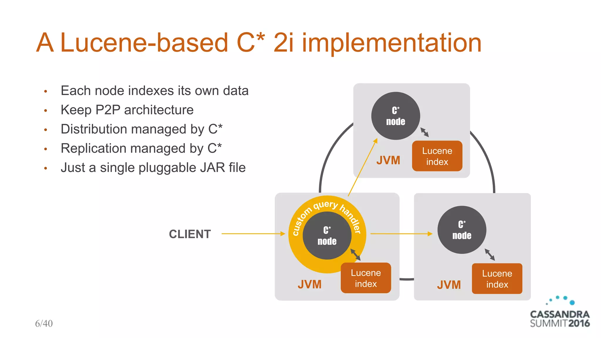
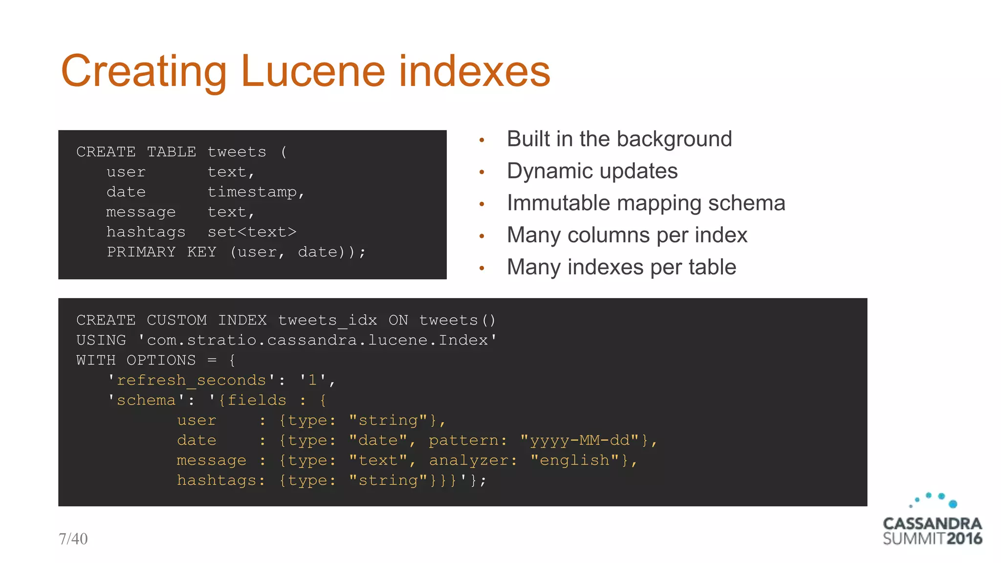
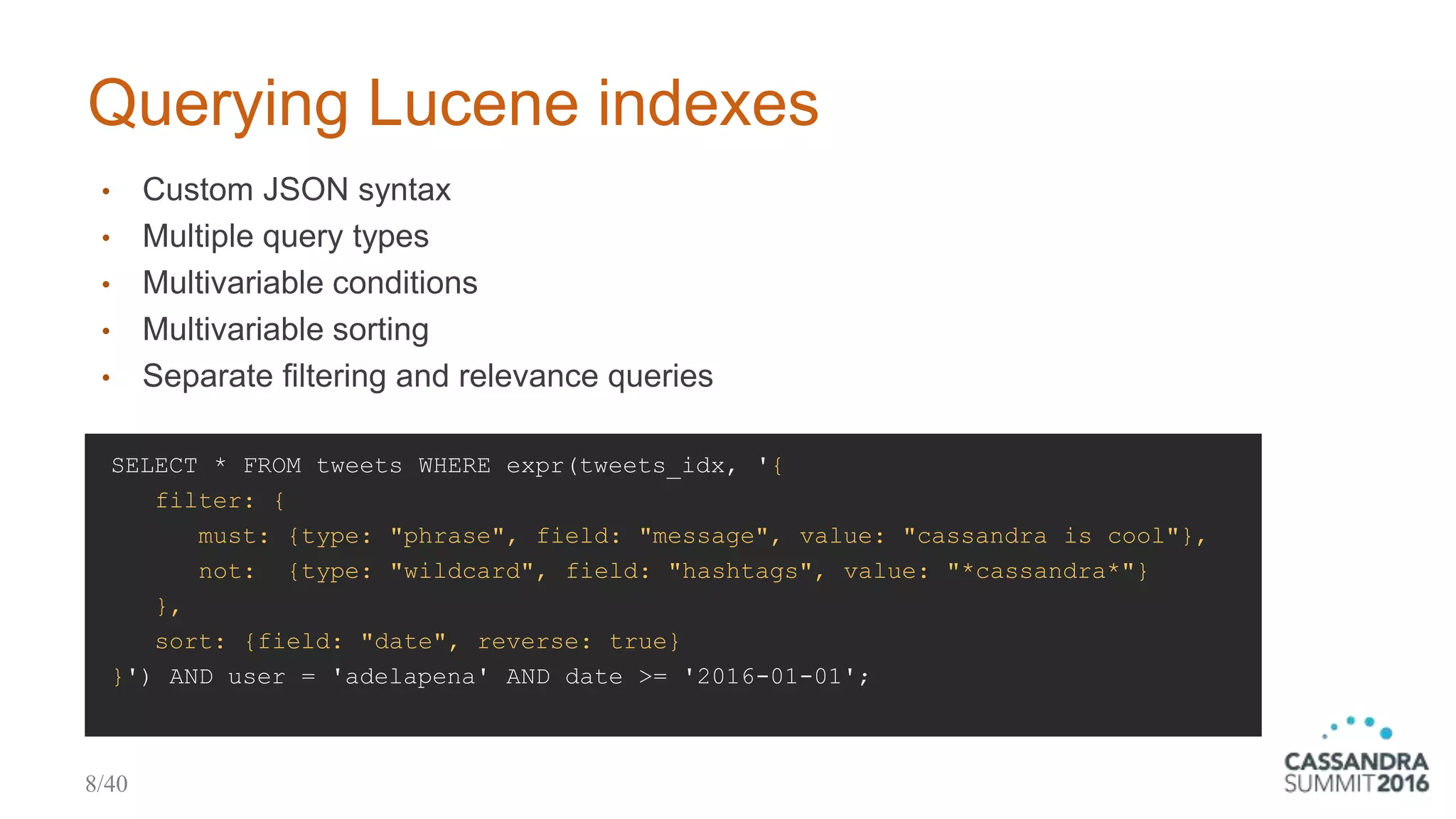
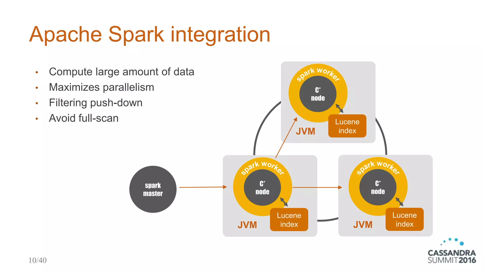
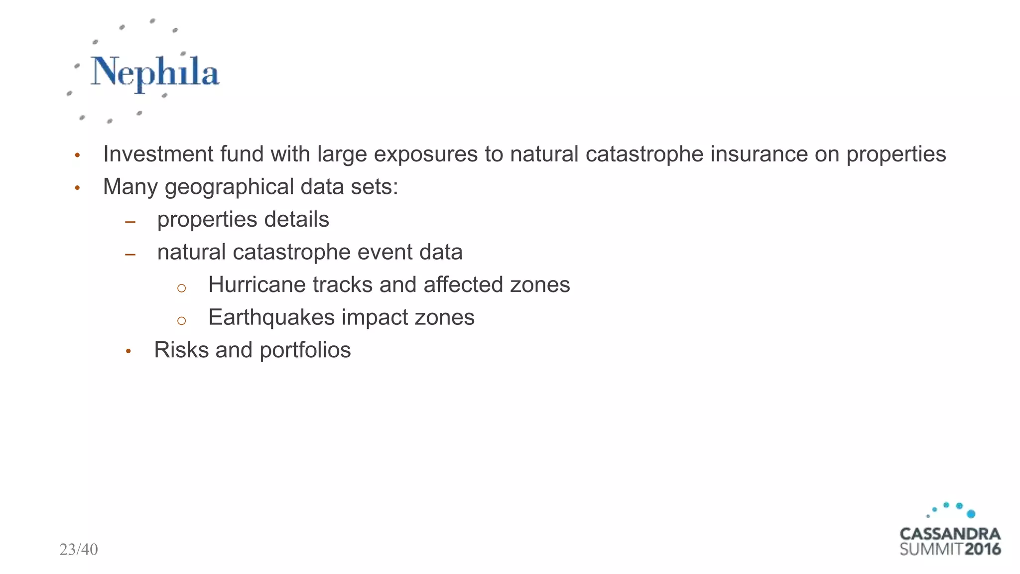
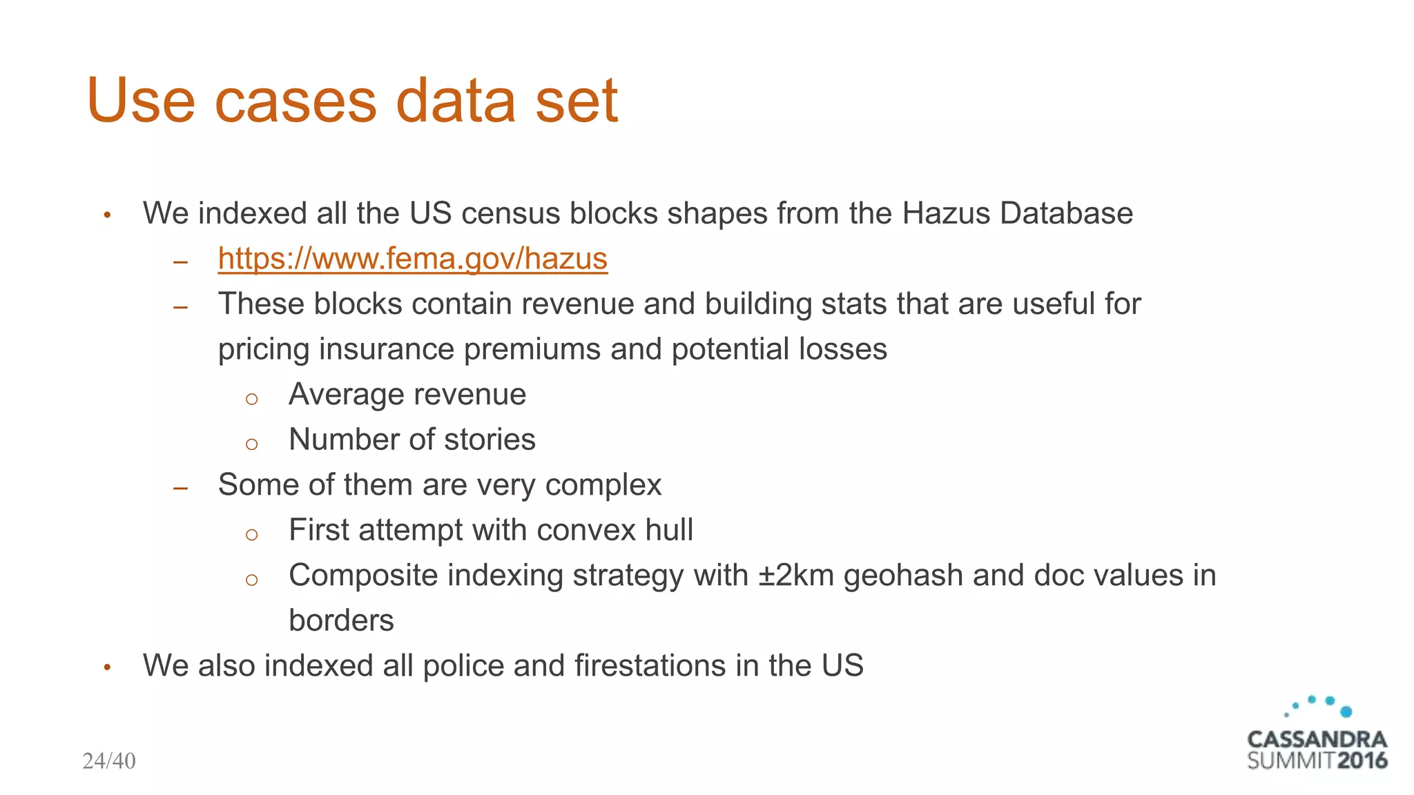
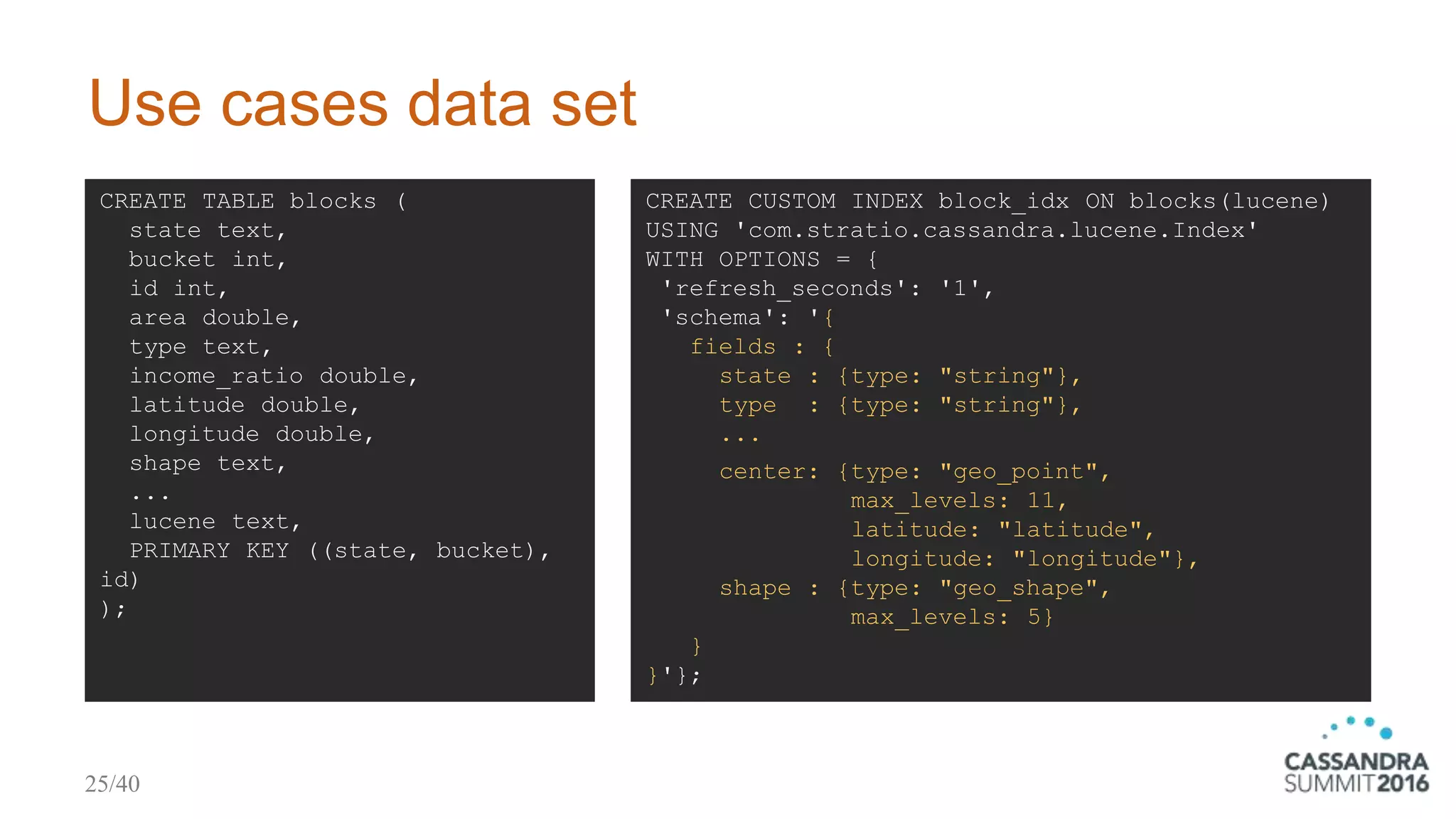
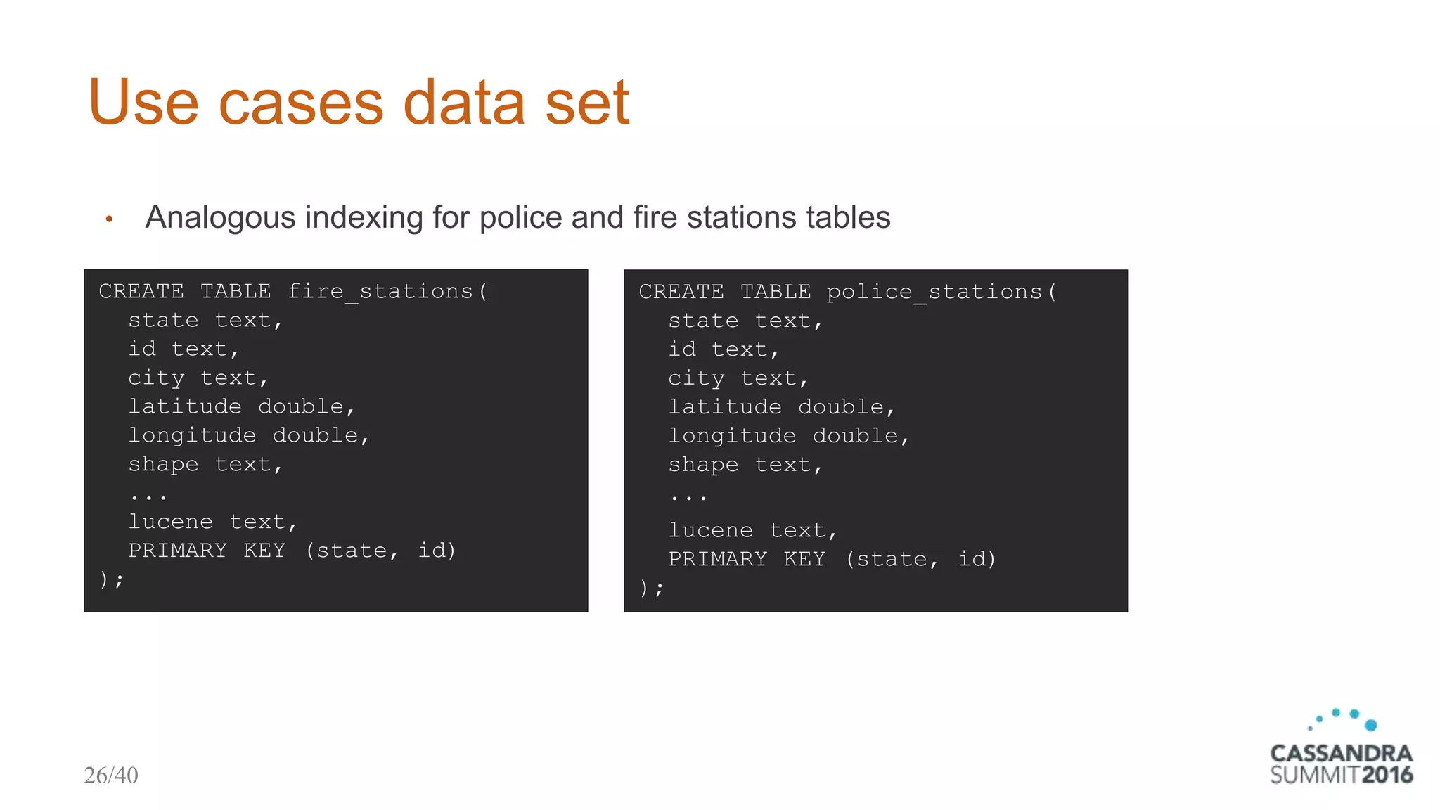
The document discusses Stratio's Cassandra Lucene index, focusing on its geospatial use cases and capabilities. It outlines the implementation of Lucene-based secondary indexes for geospatial searching, including features for complex shapes, bounding box searches, and distance sorting. Additionally, it presents various business use cases, particularly in risk analysis and insurance, demonstrating how this technology aids in processing and querying large geographical datasets.