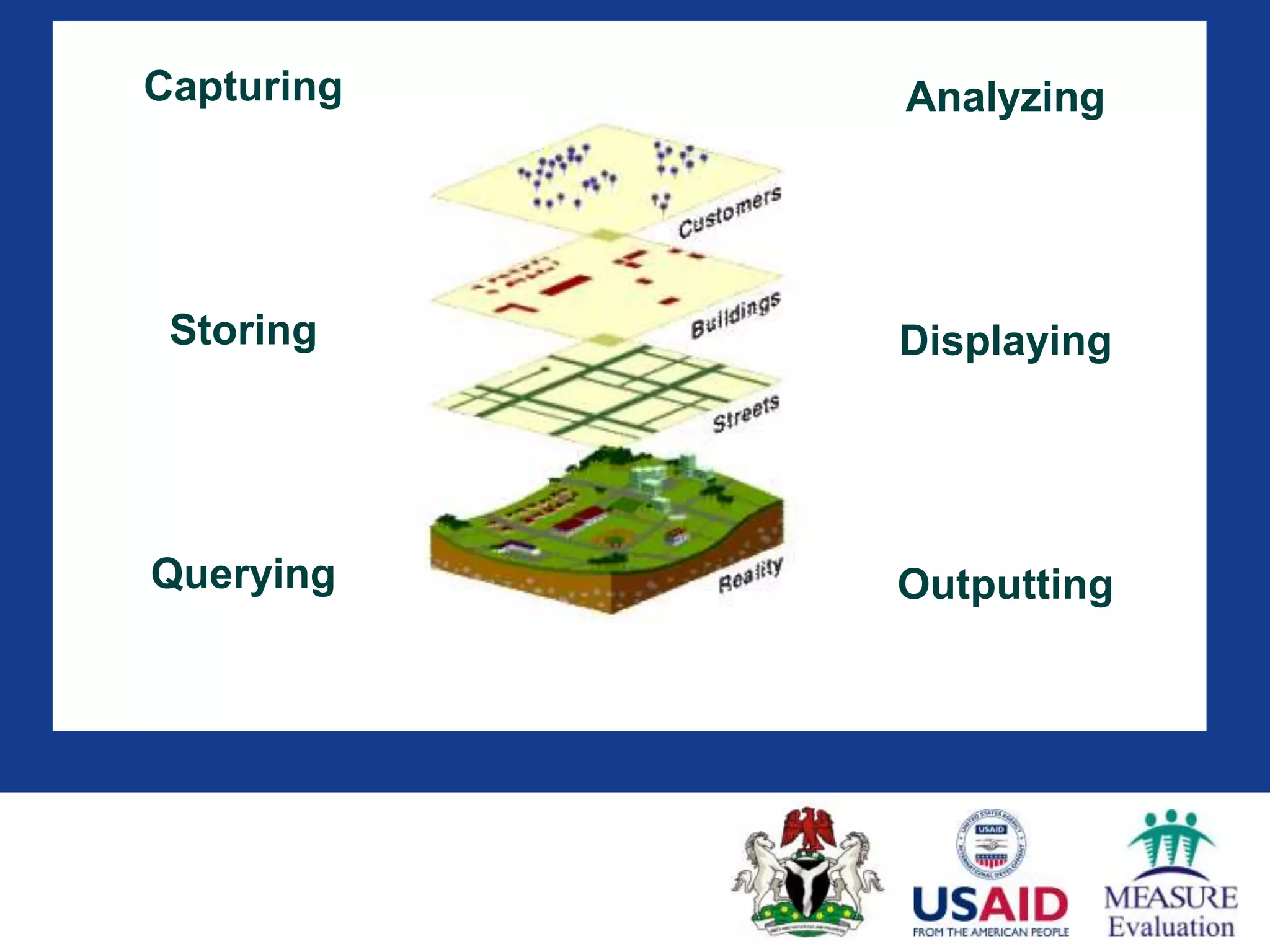
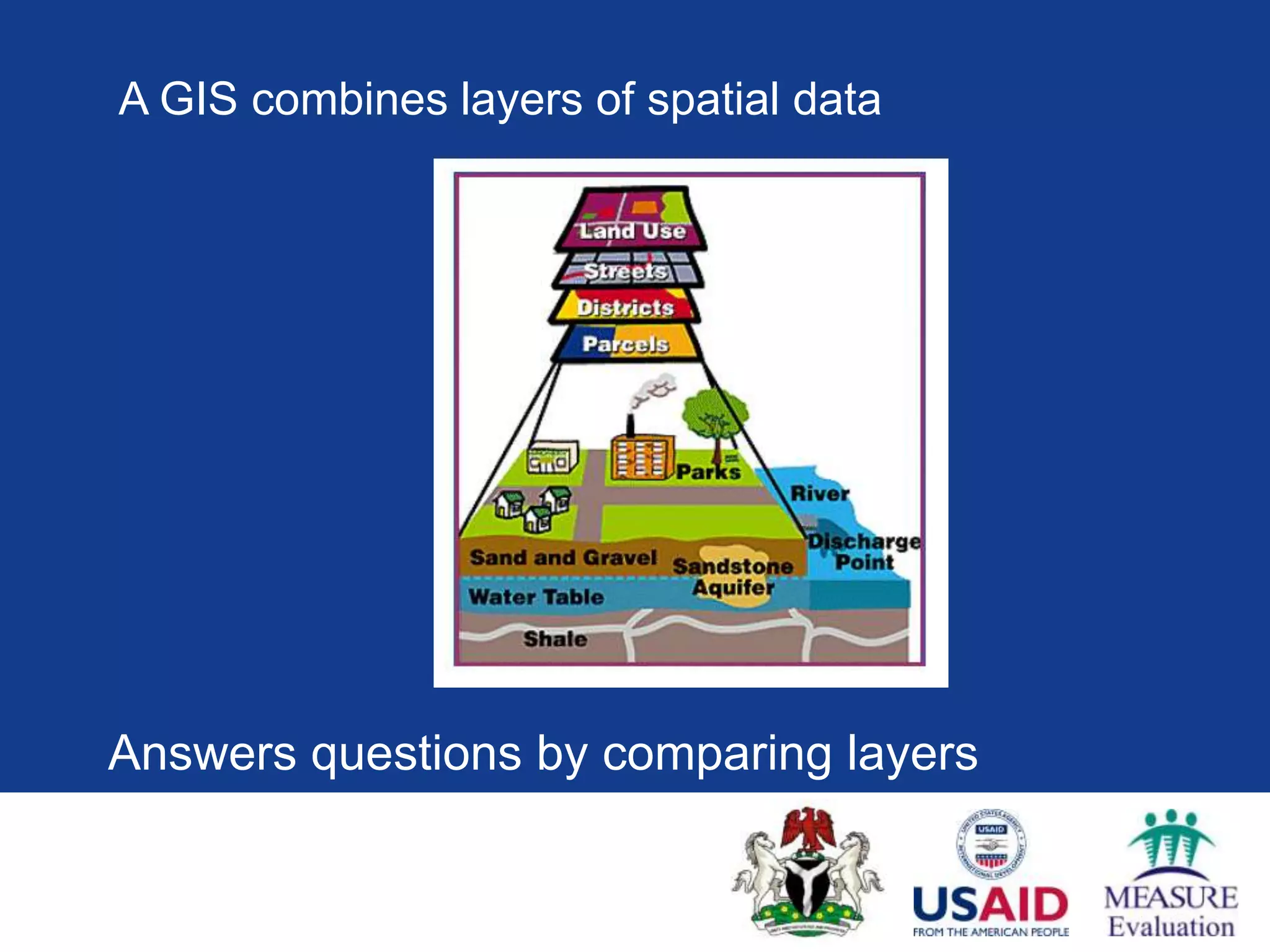
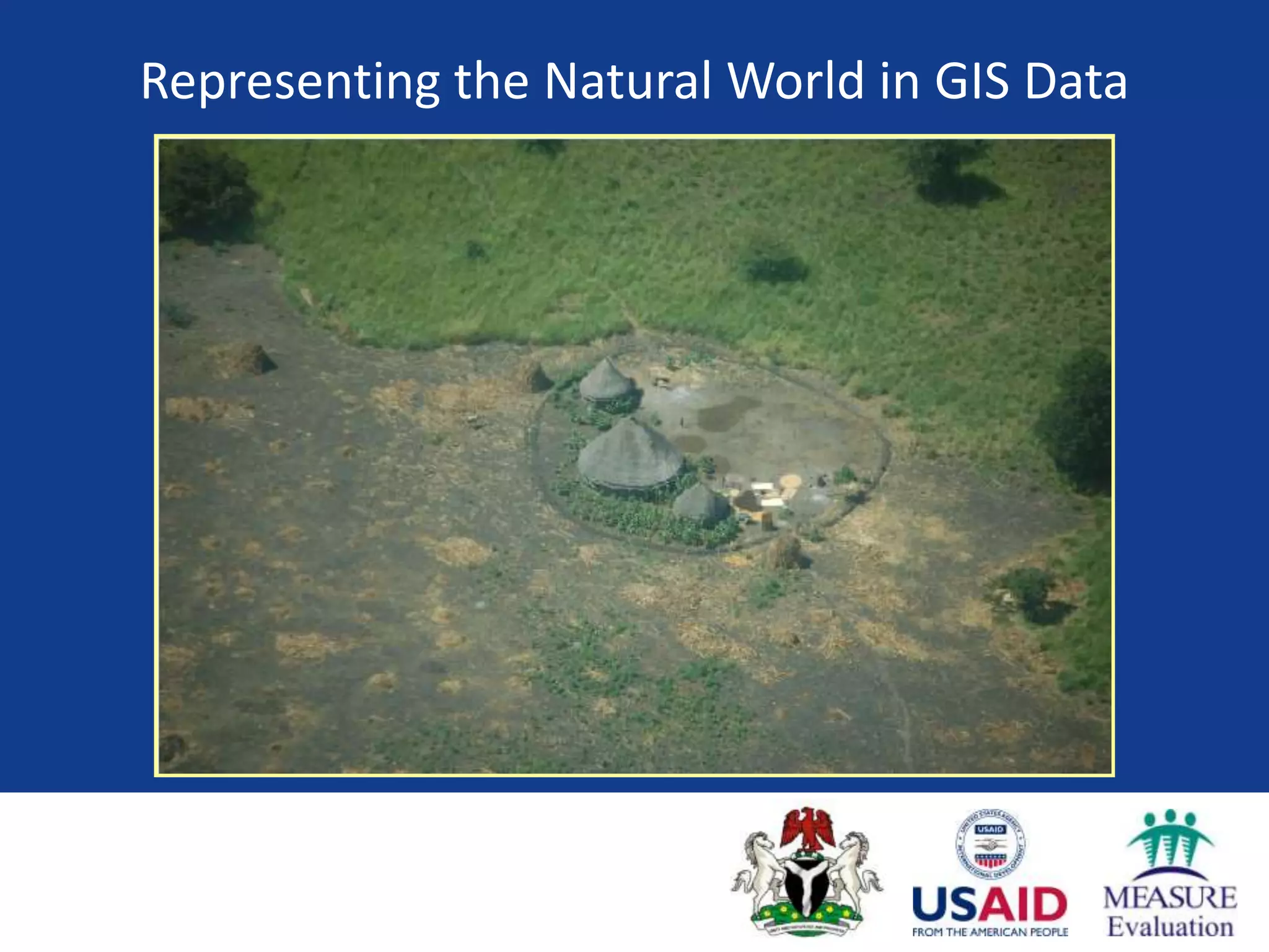
This document provides an introduction to geographic information systems (GIS) and mapping software. It discusses that GIS integrates spatial data by capturing, storing, analyzing, displaying, and outputting different layers of information. These layers can represent data as either raster images made of cells or vector features defined by points, lines, and polygons with associated attributes. The document recommends QGIS as open source software that is easy to learn and has an active user community for creating and analyzing maps.
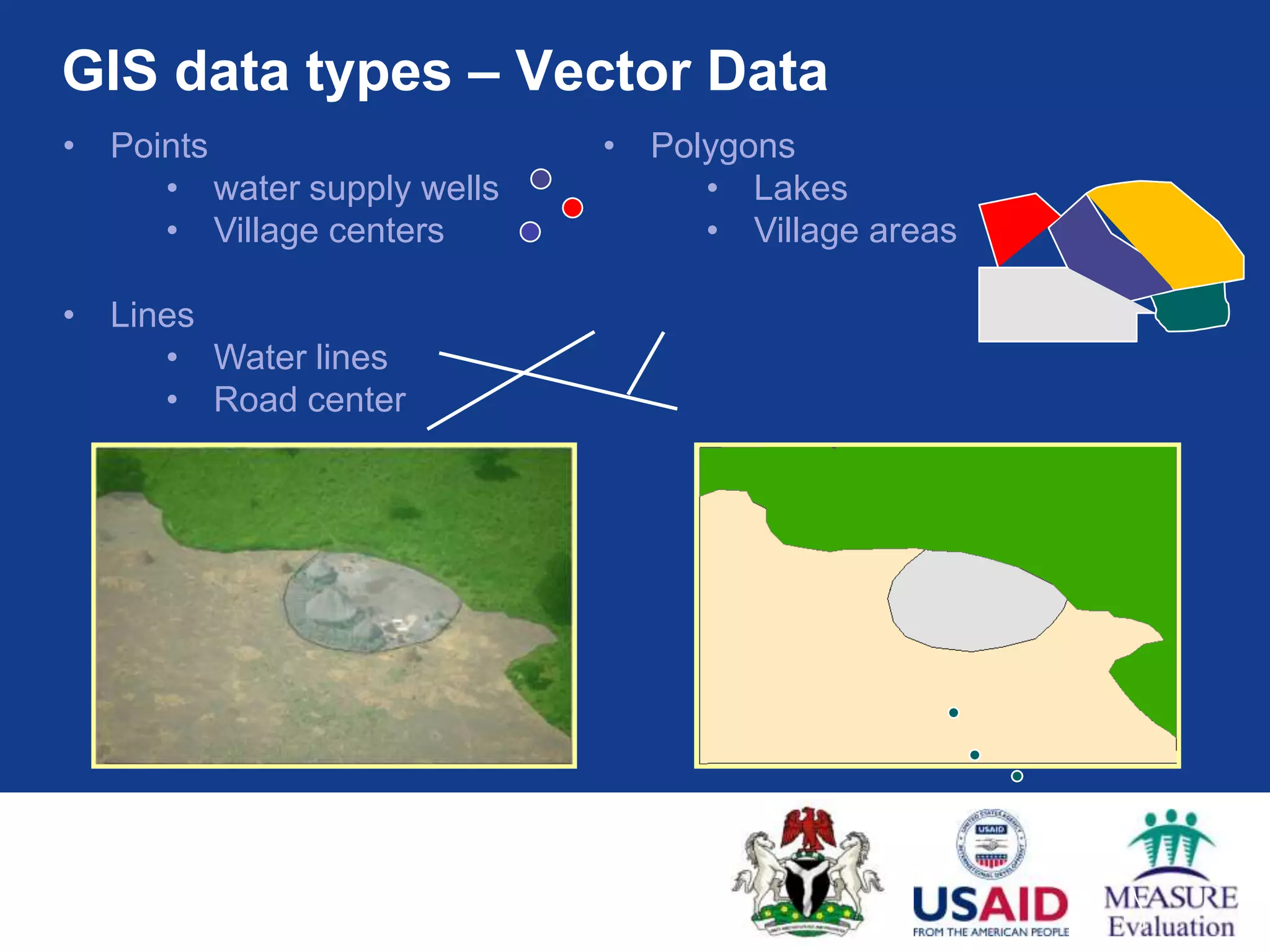
GIS data types– Vector Data
• Points • Polygons
• water supply wells • Lakes
• Village centers • Village areas
• Lines
• Water lines
• Road center
12.
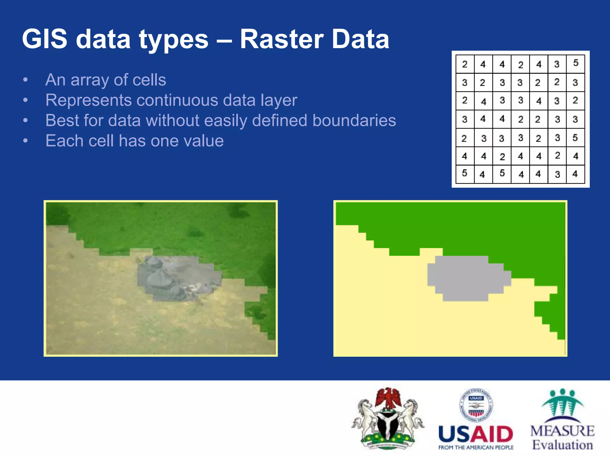
GIS data types– Raster Data
• An array of cells
• Represents continuous data layer
• Best for data without easily defined boundaries
• Each cell has one value
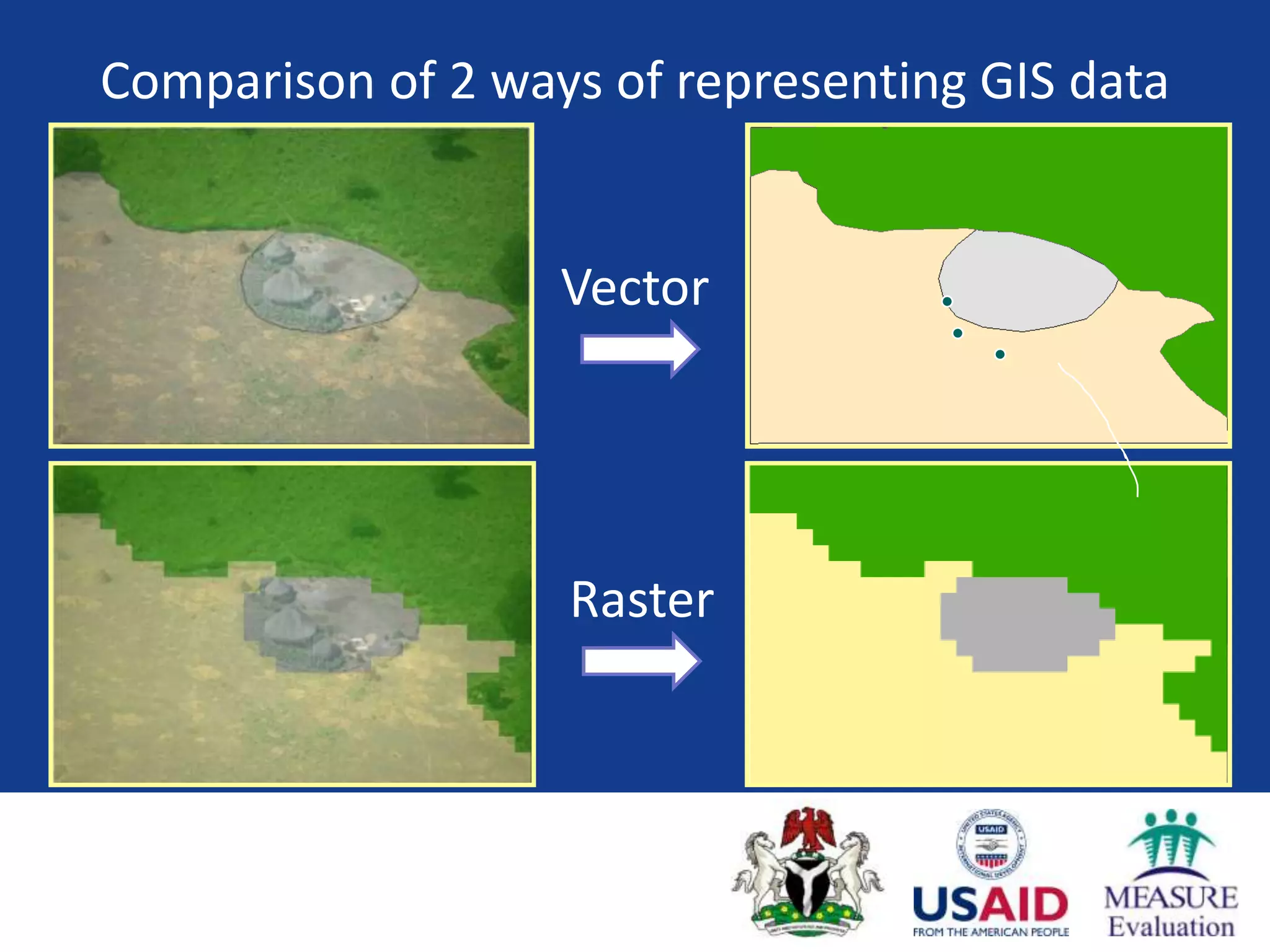
Vector Data
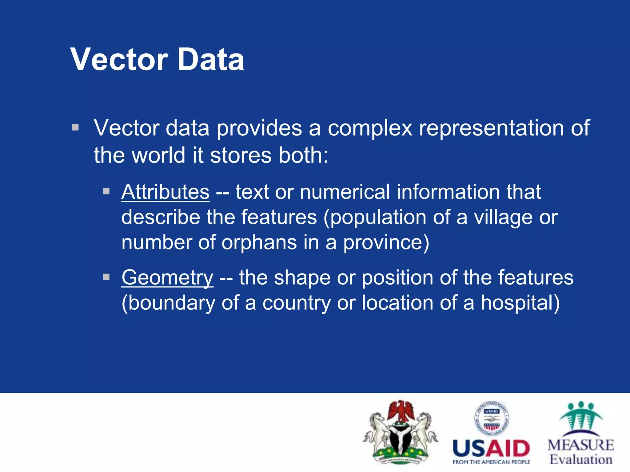
Vectordata provides a complex representation of
the world it stores both:
Attributes -- text or numerical information that
describe the features (population of a village or
number of orphans in a province)
Geometry -- the shape or position of the features
(boundary of a country or location of a hospital)
15.
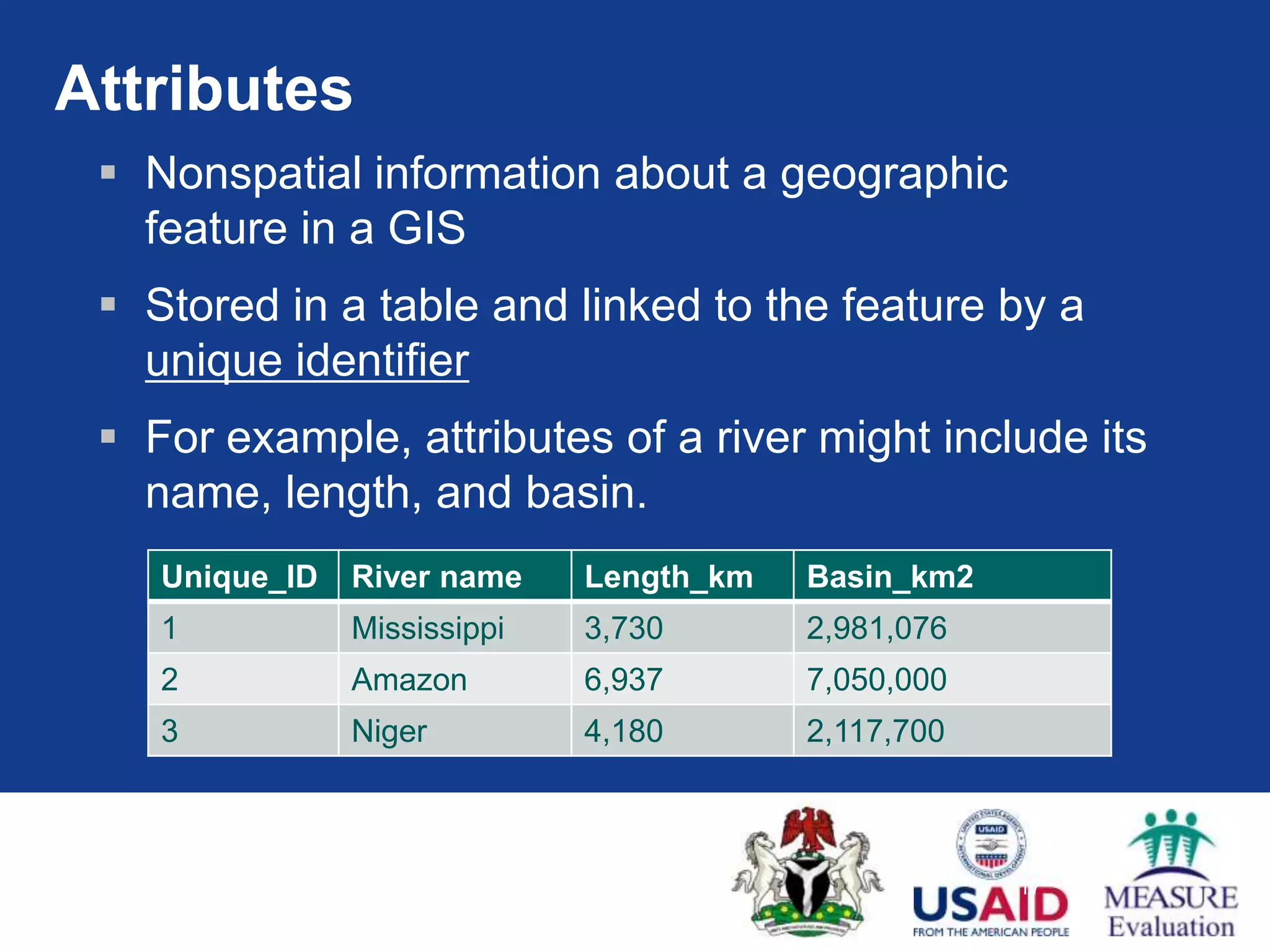
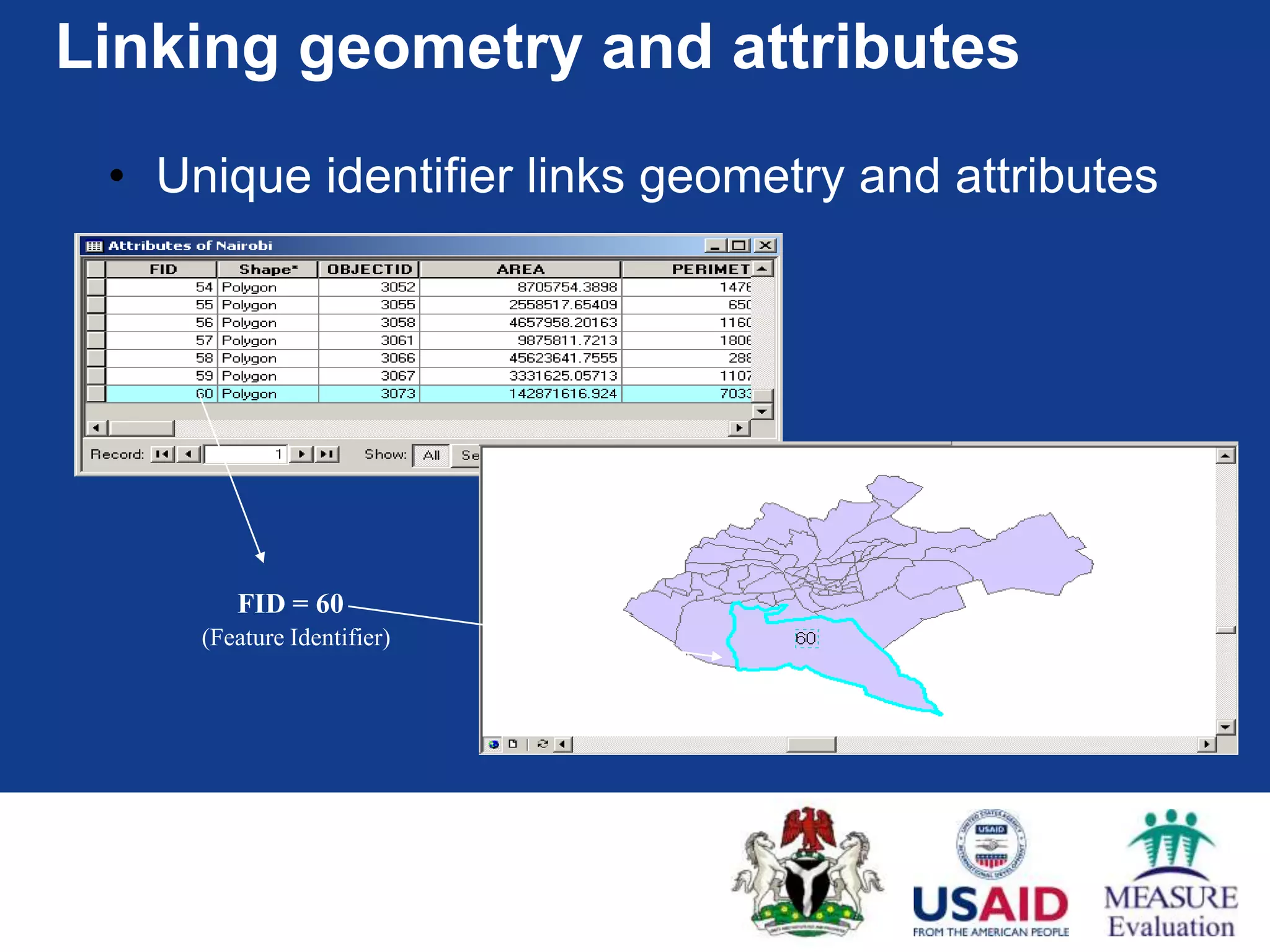
Attributes
Nonspatialinformation about a geographic
feature in a GIS
Stored in a table and linked to the feature by a
unique identifier
For example, attributes of a river might include its
name, length, and basin.
Unique_ID River name Length_km Basin_km2
1 Mississippi 3,730 2,981,076
2 Amazon 6,937 7,050,000
3 Niger 4,180 2,117,700
17
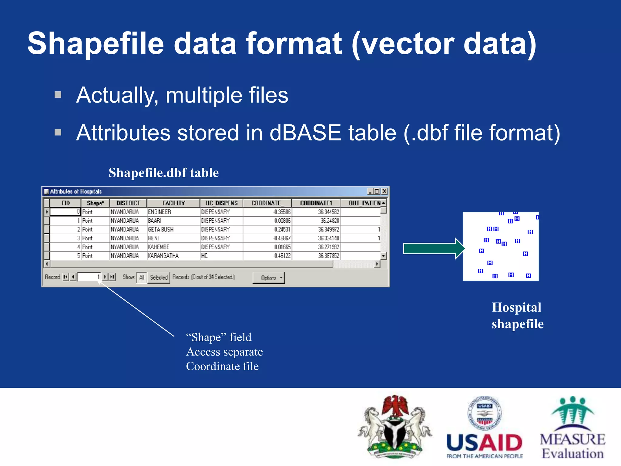
Shapefile data format(vector data)
Actually, multiple files
Attributes stored in dBASE table (.dbf file format)
Shapefile.dbf table
Hospital
shapefile
“Shape” field
Access separate
Coordinate file
18.
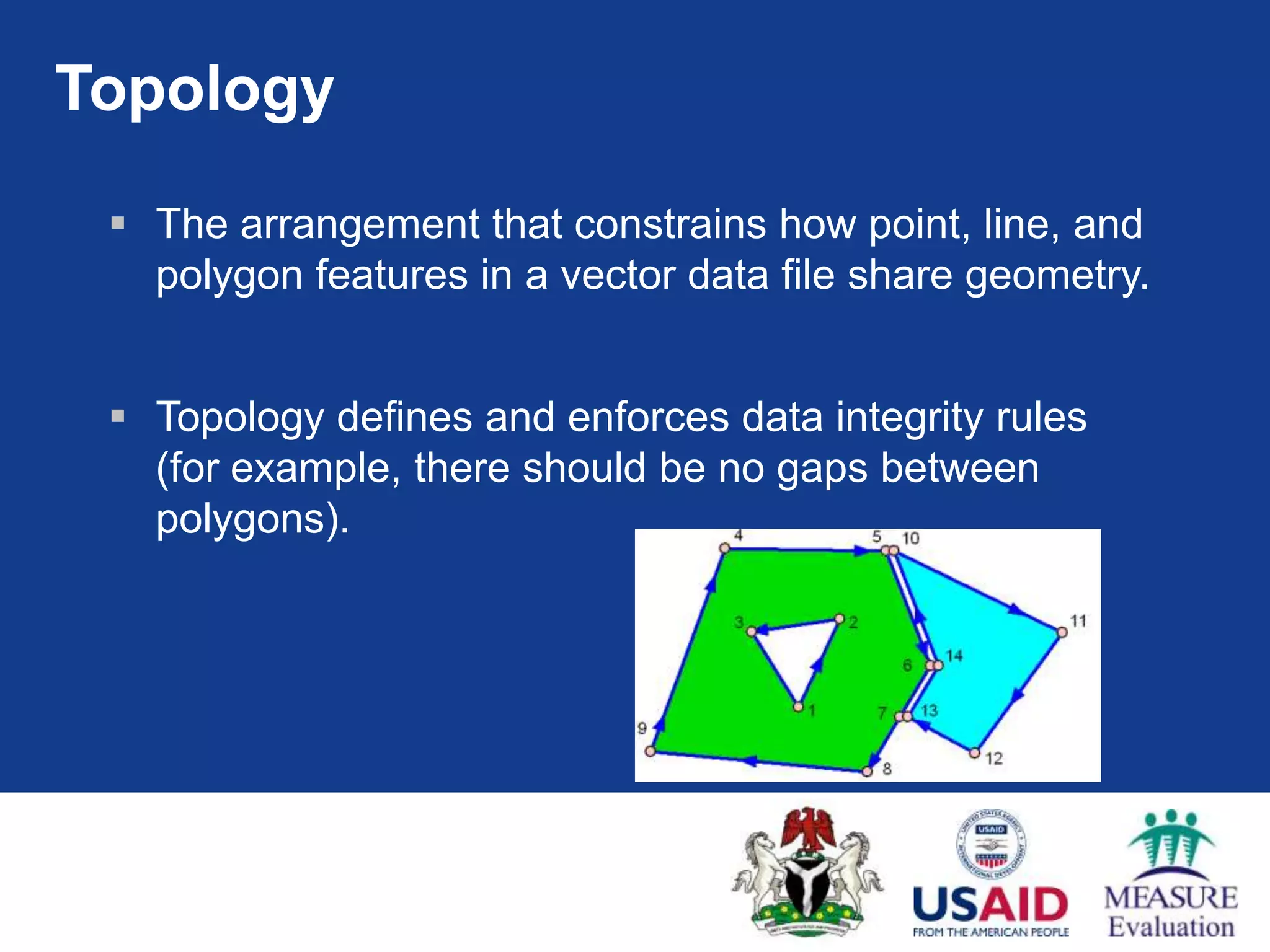
Topology
Thearrangement that constrains how point, line, and
polygon features in a vector data file share geometry.
Topology defines and enforces data integrity rules
(for example, there should be no gaps between
polygons).
19.
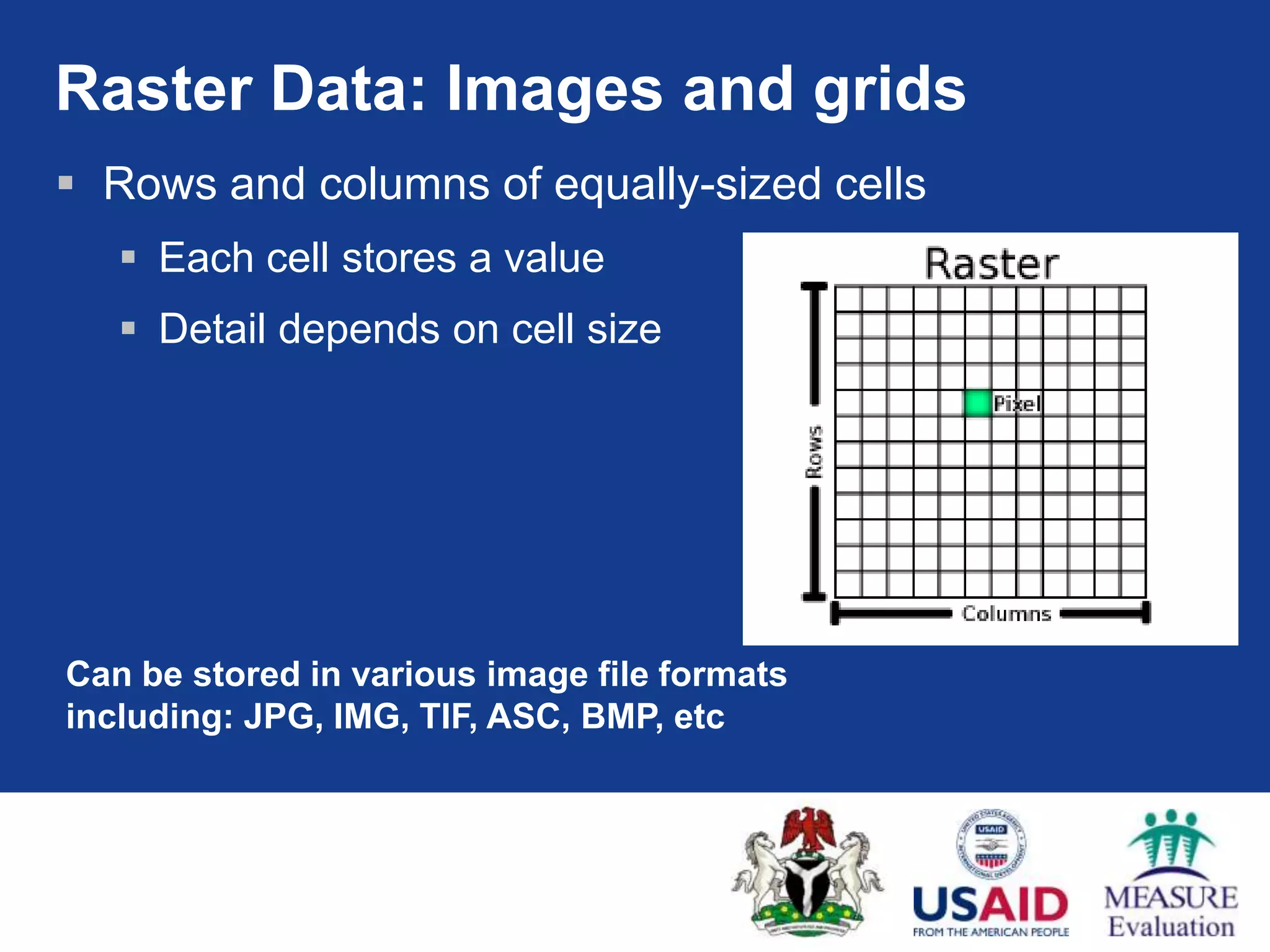
Raster Data: Imagesand grids
Rows and columns of equally-sized cells
Each cell stores a value
Detail depends on cell size
Can be stored in various image file formats
including: JPG, IMG, TIF, ASC, BMP, etc
20.
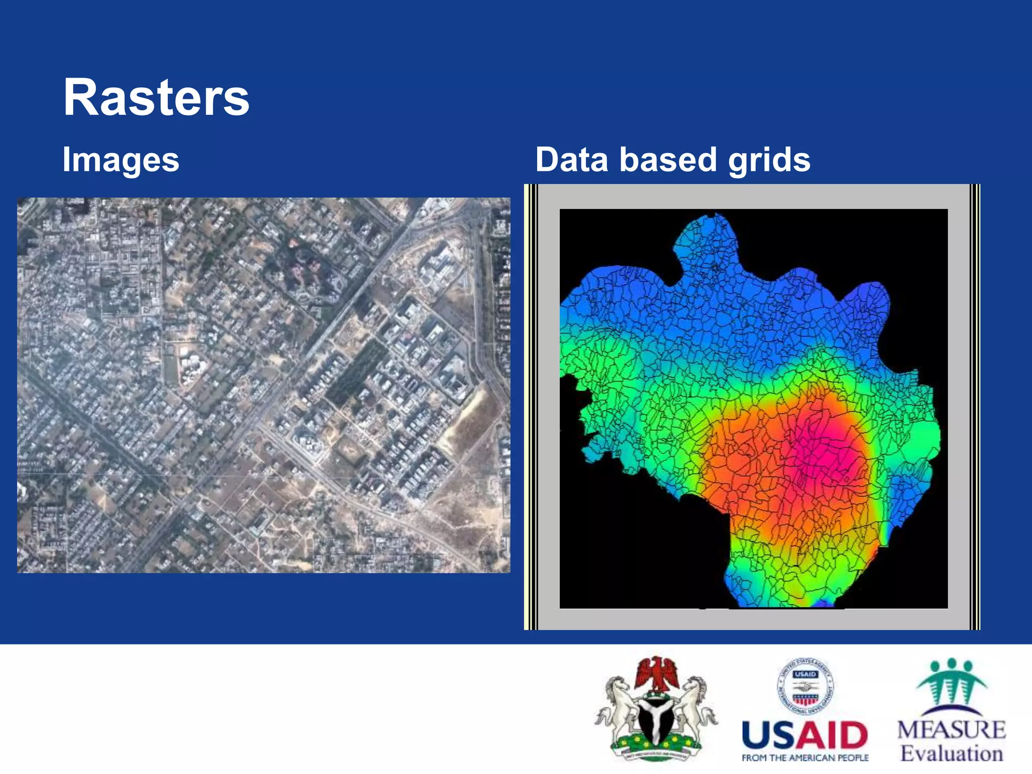
Village-wise Slide PositivityRate (M alaria) of Trans-Yamuna Region
Rasters 2002 2004
Images Data based grids
Low High
21.
Open Source GISSoftware
Diva GIS
Dev-Info
Health Mapper
E2G
QGIS
others?
22.
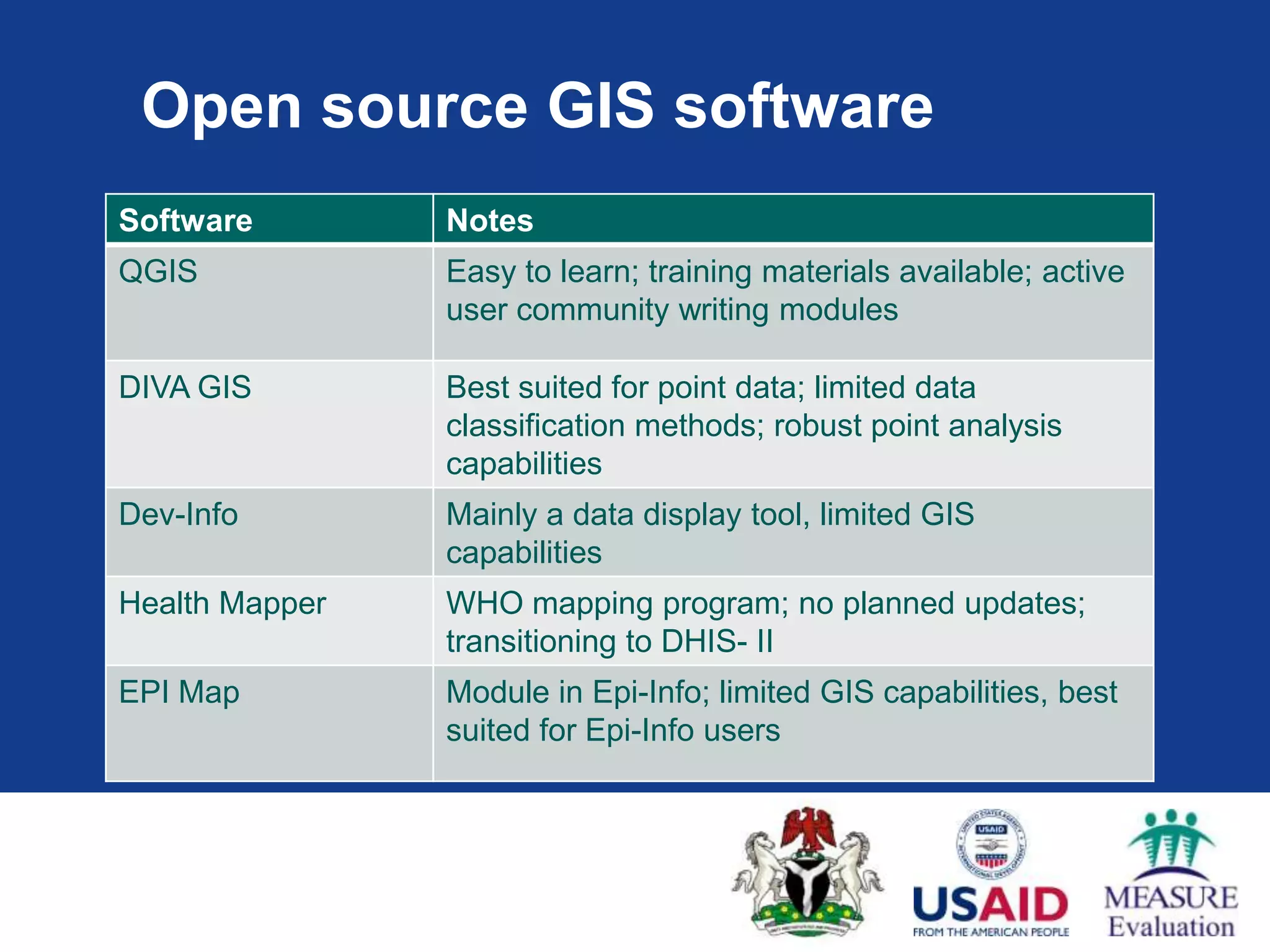
Open source GISsoftware
Software Notes
QGIS Easy to learn; training materials available; active
user community writing modules
DIVA GIS Best suited for point data; limited data
classification methods; robust point analysis
capabilities
Dev-Info Mainly a data display tool, limited GIS
capabilities
Health Mapper WHO mapping program; no planned updates;
transitioning to DHIS- II
EPI Map Module in Epi-Info; limited GIS capabilities, best
suited for Epi-Info users
23.
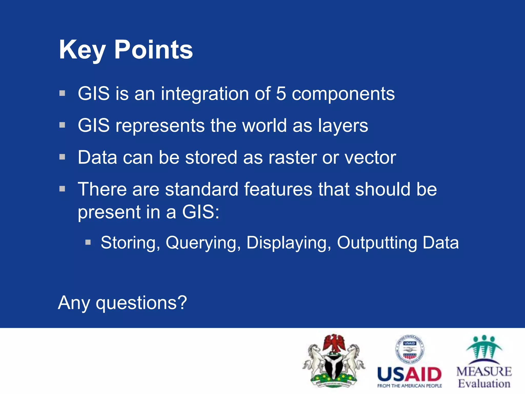
Key Points
GISis an integration of 5 components
GIS represents the world as layers
Data can be stored as raster or vector
There are standard features that should be
present in a GIS:
Storing, Querying, Displaying, Outputting Data
Any questions?